Rare Books Just In
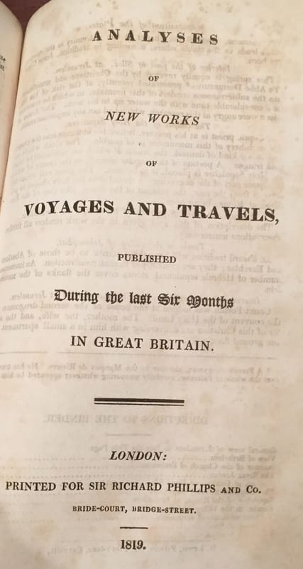
Six Volume set of New Voyages and Travels:
|
|


Volume 1.
|
|

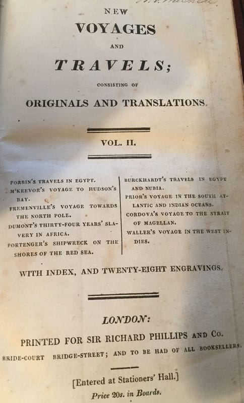

Volume 2
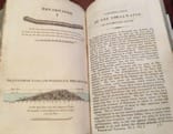
New Voyages and Travels: Consisting of Originals, Translations 1819-1823. Volume 2;-
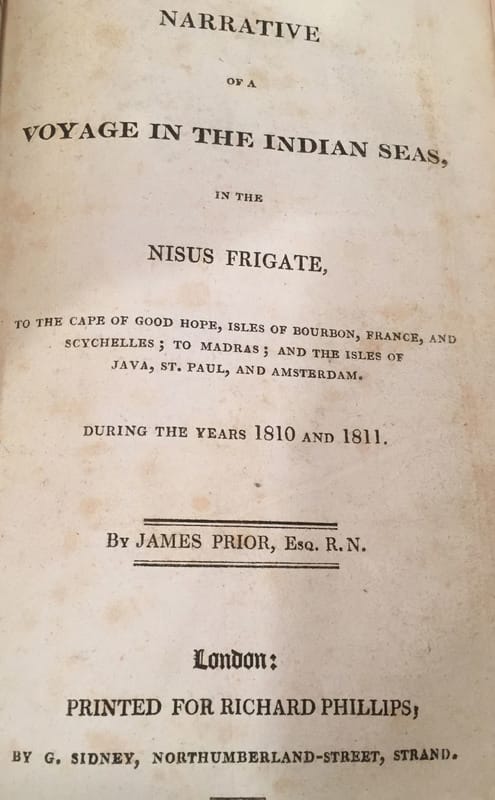
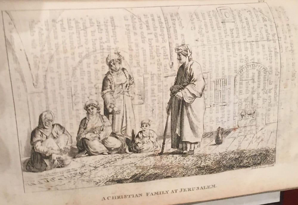
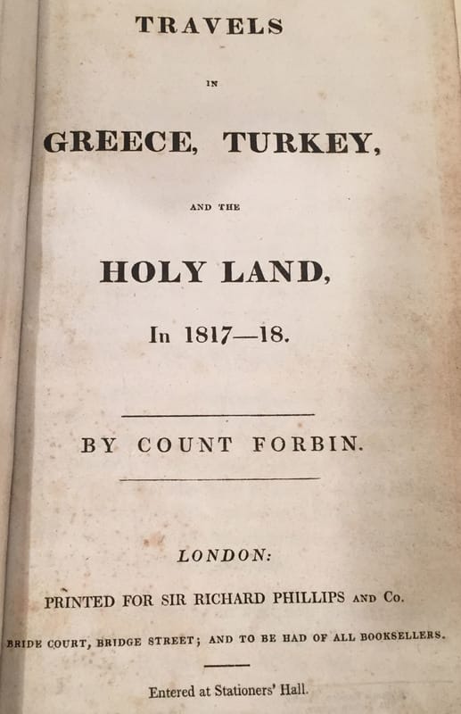
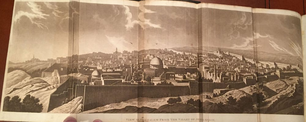
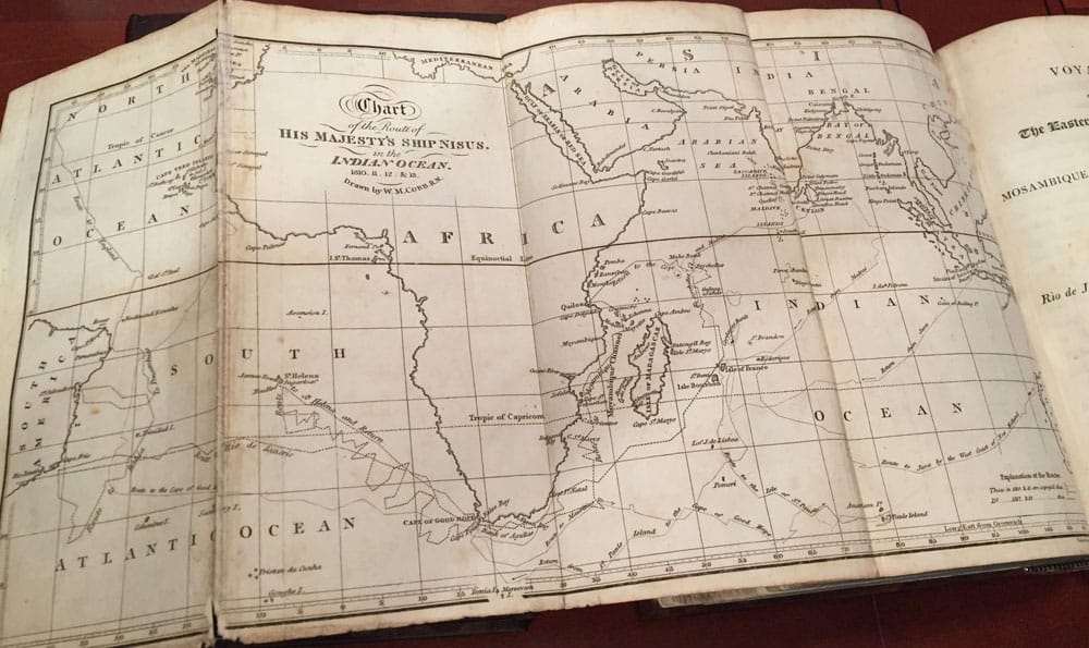
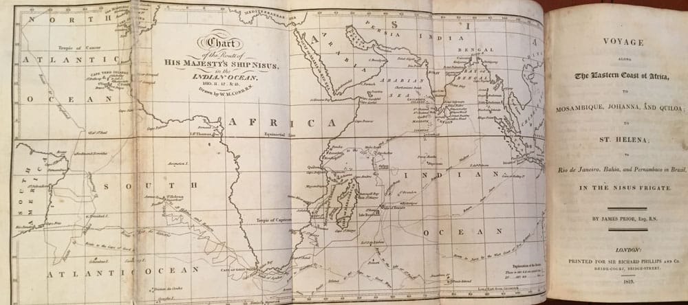
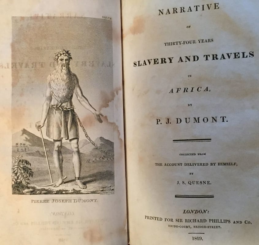
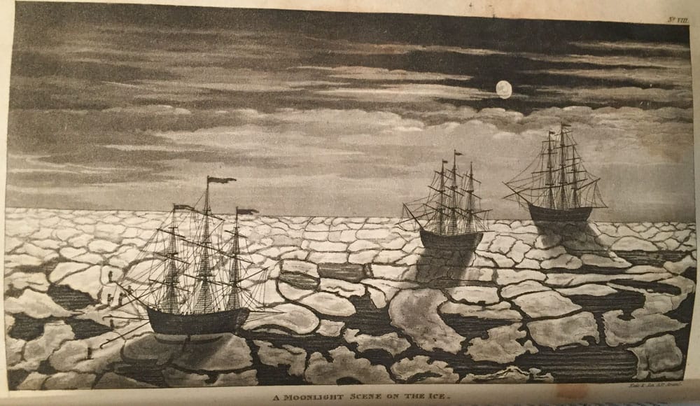
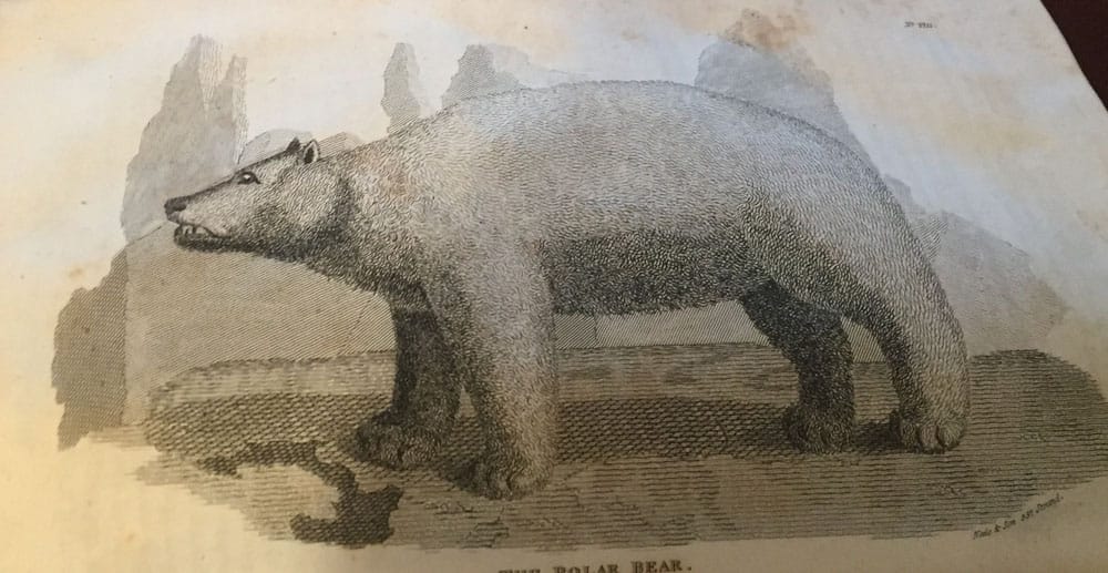
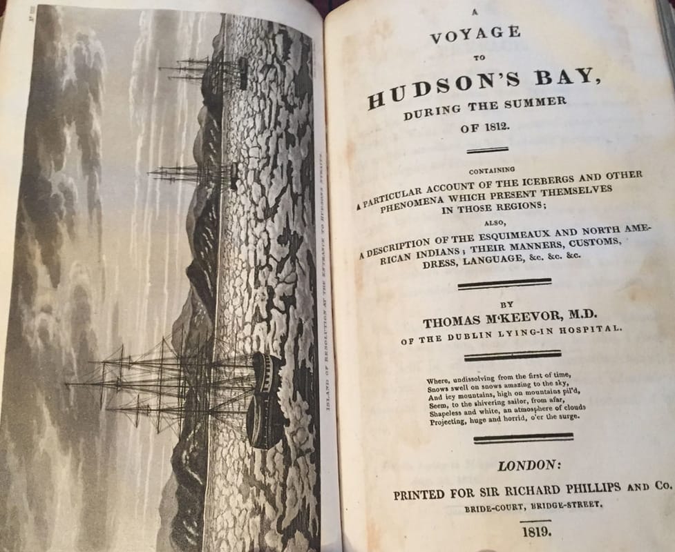
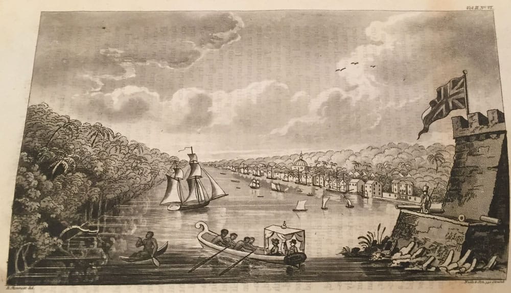
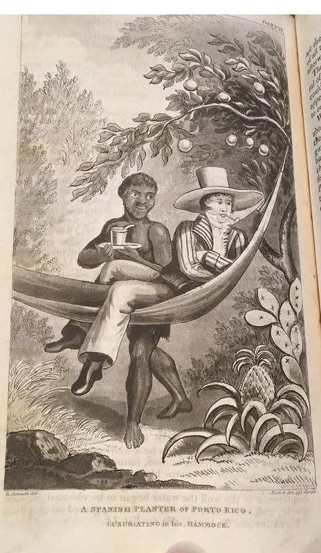
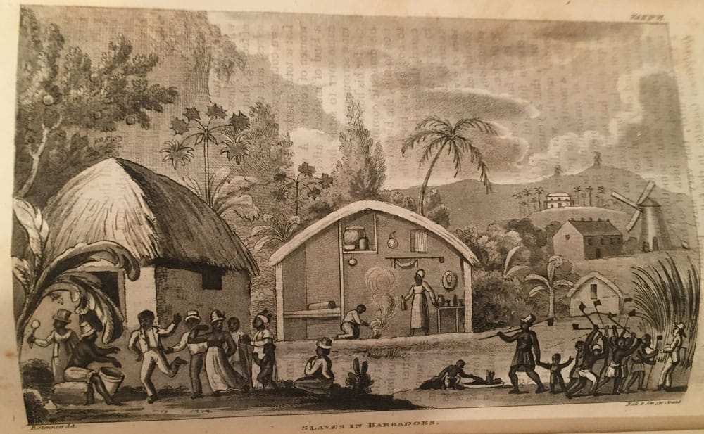
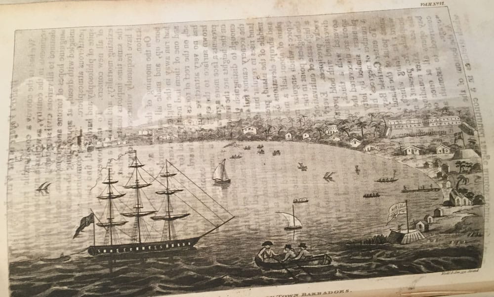
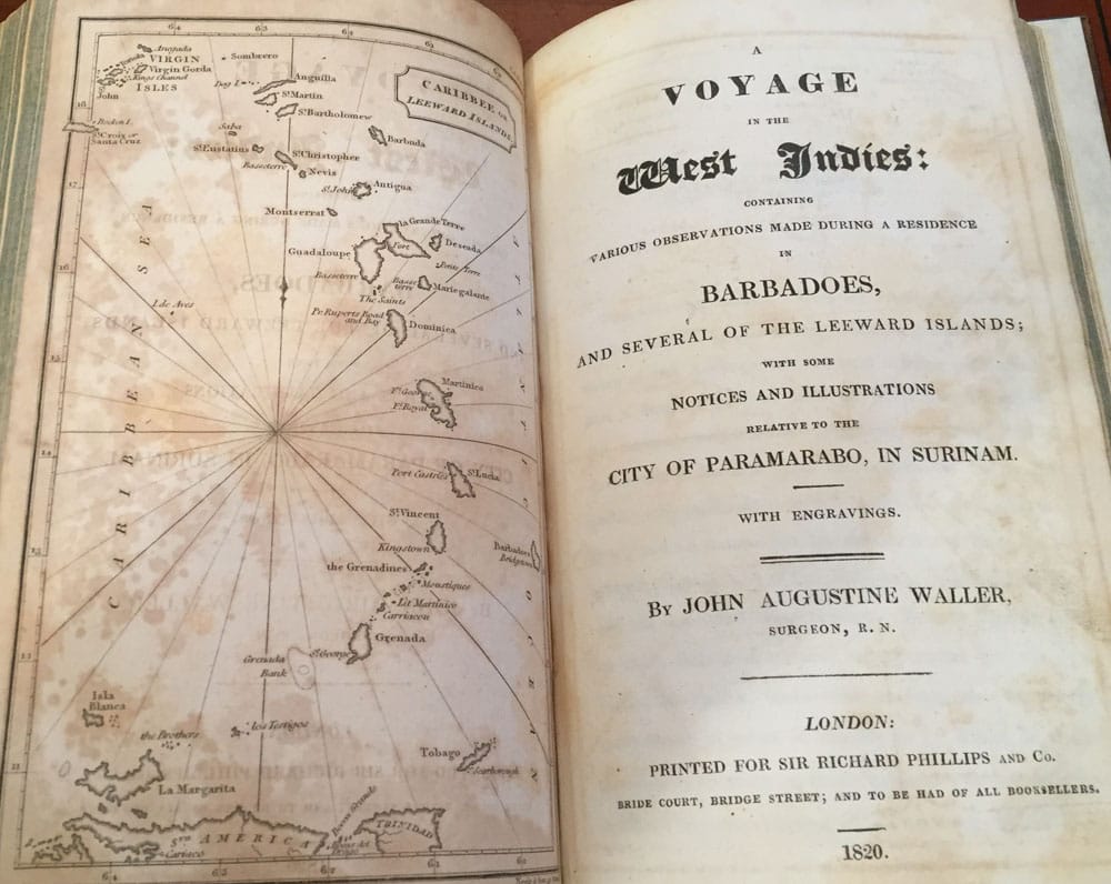
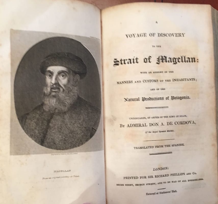
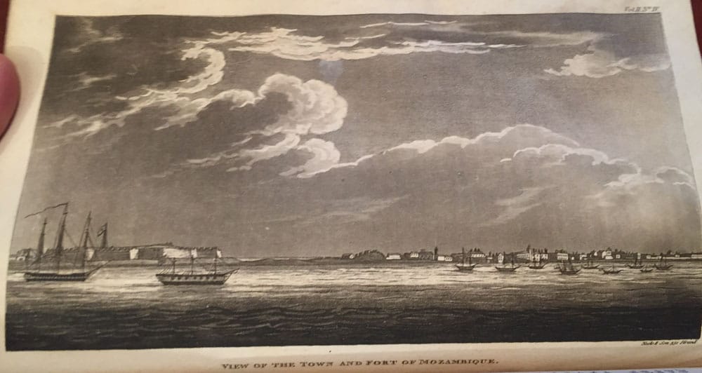
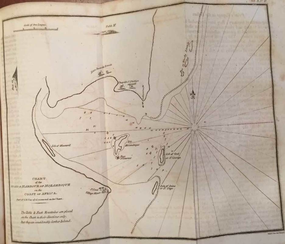
Edited and Published by Sir Richard Phillips. 1819. The 8 books within one, in Volume 2, each has its own title page. This Volume 2 consist of first story.. followed by 8 more travel stories;- New Voyages and Travels: Volume 2 ;- Bound in fine stunning original antique parchment with old hand-written script to front and back of the binding. Foldout Chart of the opposite main title page;- 1. Travels in Egypt, Travels in the Holy Land in 1817-1818 by Count Forbin. With a large fold-out map, a general view of the Pyramids of Gheza. 8 other full page engraved plates. 96 pages. 2. A Voyage to Hutson’s Bay Summer 1812, an account of Icebergs and other phenomena;- A description of the Esquimaux and North American Indians. By Thomas M’Keevor M.D. of Dublin Lying-in Hospital. An engraved plate “Island of Resolution” at the entrance to Hudson Bay, opposite the title page. And 5 more full page engravings. The most famous is the Polar Bear. 76 pages with 2 pages of Vocabulary of the Dialects of the Northern and Chippeway Indians. Added with a separate title-page “Voyage to the North Pole” in the Frigate “The Syrene" to the Island of Iceland by Chevalier de la Poix de Freminville. 1819. 24 pages . 3. Narrative of Thirty-four Years’ Slavery and Travels in Africa,1819 by P.J.Dumont. Portrait of Pierre Joseph Dumont opposite title-page. 42 pages and a two page Supplement added to the final page of 42 pages. 4. Narrative of the Suffering and Adventures of Henderick Portenger, a Private Soldier who was wrecked on the Shores of Abyssinia, in the Red-Sea. By R. De May, Captain of the Regiment. 28 pages including title page. 1819. 5. Travels of M. Burckhardt, in Egypt and Nubia. 32 pages including title page. 1819. 6. Voyages along the Eastern Coast of Africa, to Mozambique , Johanna and Quiloa; to St. Helena; to Rio de Janeiro, and Pernambuco, in Brazil. By James Prior R.N. Chart of the Route of the Nisus in the Indian Ocean opposite title-page. Also a Chart of the Road and Harbour of Mozambique on the Coast of Africa. View of Town and Fort of Mozambique. 114 pages including title page. 1819. 7. A Voyage of Discovery to the Strait of Magellan; with an Account of the Inhabitants; the National Productions of Patagonia, by Admiral Don A. de Cordova. Portrait of Magellan, opposite title-page. Chart of the Strait of Magellan; 104 pages including title page. 1819. 8. A Voyage in the West Indies, Barbados, Leeward Islands;- the City of Paramarabo, in Surinam, by John Augustine Waller, Surgeon, R.N. Map of the Caribbee or Leeward Islands opposite title-page, plus 5 other full engraved plates. 105 pages including title page. 1820. And finally 12 pages of an Index to Volume 2 to the last pages. |

|


Volume 3.
|
|


Volume 4.
New Voyages and Travels: Consisting of Originals, Translations 1819-1823.
Volume 4.
Price $2,550 Buy Now


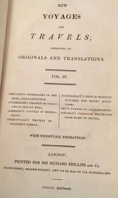
New Voyages and Travels: Consisting of Originals, Translations 1819-1823. Volume 4.
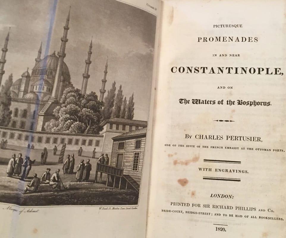
Edited and Published by Sir Richard Phillips. 1820-1823. The 8 books within one, in Volume 4, some have there own title page. This Volume 4 consist of first story.. followed by 6 more travel stories;- New Voyages and Travels: Volume 4. Bound in fine stunning original antique parchment with old hand-written script to front and back of the binding. 20 pages Index to Volume 4 to the first few pages. Before the opening chapter Picturesque Promenades in and near Constantinople.
2. Travels in Sicily and to Mount Etna in 1819 by M. Gourbillon. 1820 Title-page, with a small engraving of the Cone of Etna, House of Refuge, Philosopher’s Tower. And three other full page engravings, 112 pages in total.
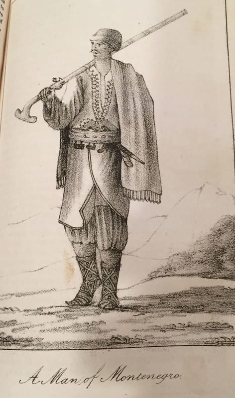
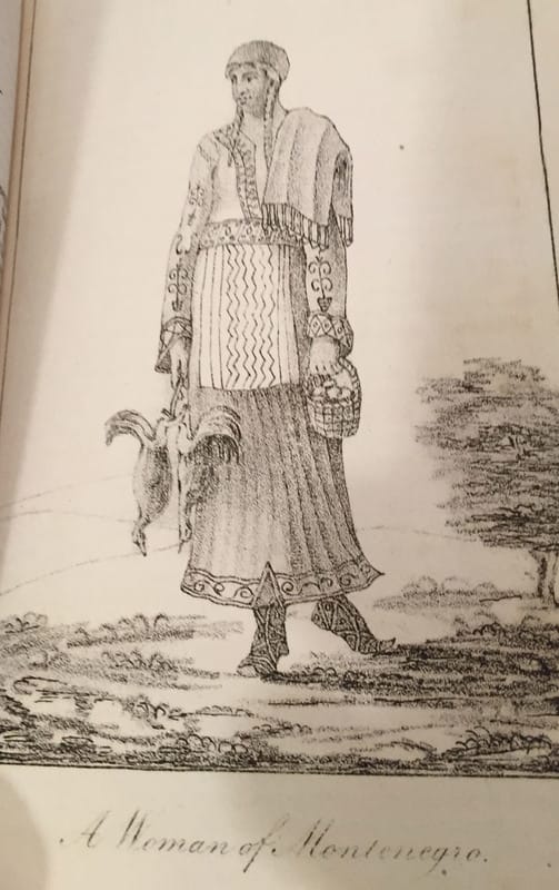
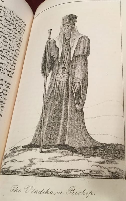
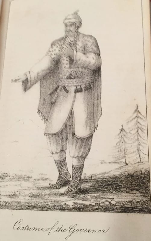
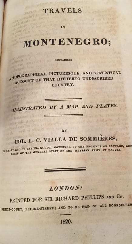
3. Travels in Montenegro; containing a Topographical, Picturesque, and Statistical Account of that hitherto under scribed Country, by Col. L. C. Vialla De Sommiere. 1920;- 8 full page engravings, including the first full page plate is a hand-coloured plate of Cattaro below Montenegro; 108 pages in total.
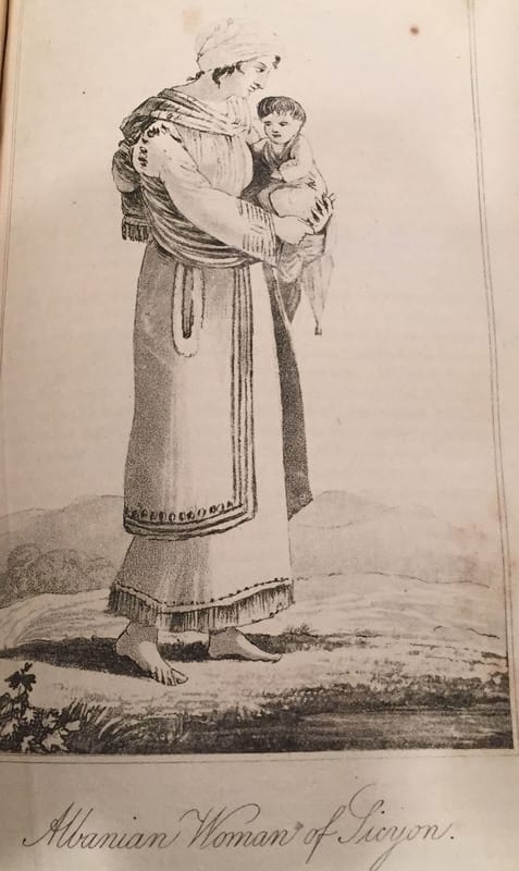
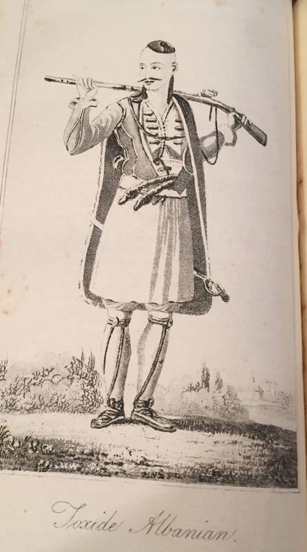
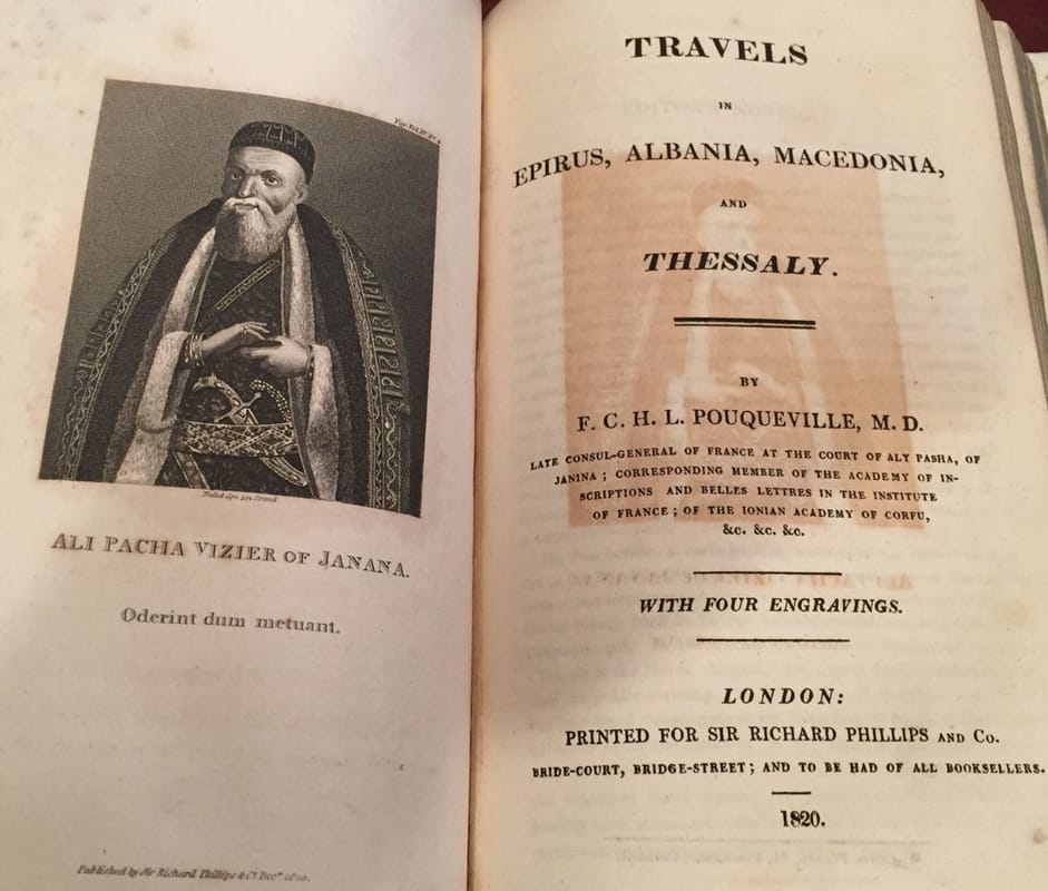
4. Travels in Epirus, Albania, Macedonia, and Thessaly, by F. C. H. L. Pouqueville, M. D. 1820;- Ali Pacha Vizier of Janana opposite the main title page. And three other engraved plates. 122 pages in total.
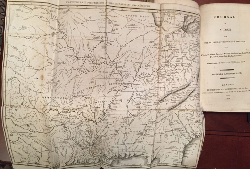
5. Journal of the Tour into the Interior of Missouri and Arkansaw, 1818-1819, from Potosi, or Mine a Burton, in Missouri Territory, in South-West Direction, towards the Rocky Mountains, by Henry R. Schoolcraft. Large Fold-Out engraving Map of Missouri and Arkansaw, opposite the main title page.
And the page behind the Fold-Out of Missouri and Arkansaw, is a one page NOTICE. 122 pages in total, including A Poem in 11 pages to the back pages of this section, by Henry R. Schoolcraft, Transallegania, or The Groans of Missouri.
6. Voyage from France to Cochin-China, by Capt. Rey, 1819-1820. Published in 1821. No plates called for.
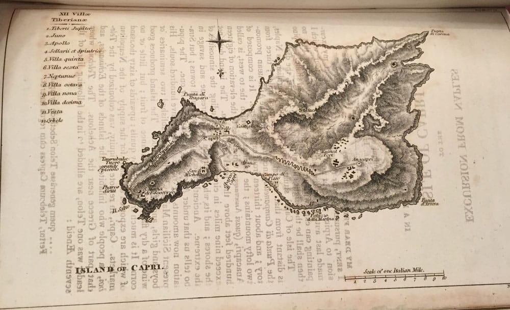
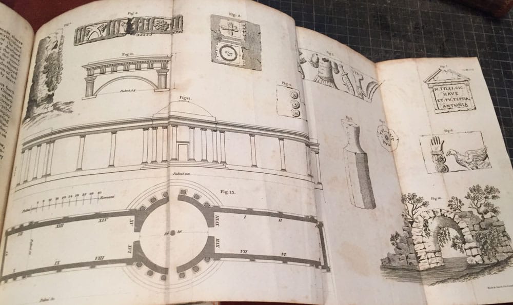
7. Classical Excursion from Rome to Arpino by Charles Kelsall. 1821;-
First engraved plate is a Large Fold-Out engraving, called Miscellaneous Antiquites. And four more full page engraved plates. 107 pages in total, last pages of this Volume 4 has a Postscript page.
Edited and Published by Sir Richard Phillips. 1820-1823. The 8 books within one, in Volume 4, some have there own title page. This Volume 4 consist of first story.. followed by 6 more travel stories;- New Voyages and Travels: Volume 4. Bound in fine stunning original antique parchment with old hand-written script to front and back of the binding. 20 pages Index to Volume 4 to the first few pages. Before the opening chapter Picturesque Promenades in and near Constantinople.
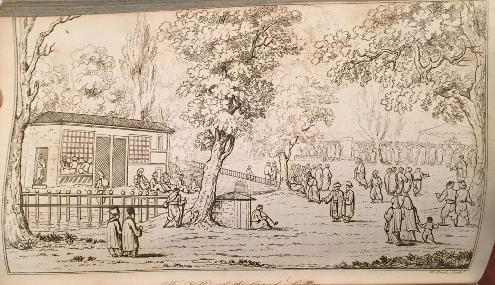
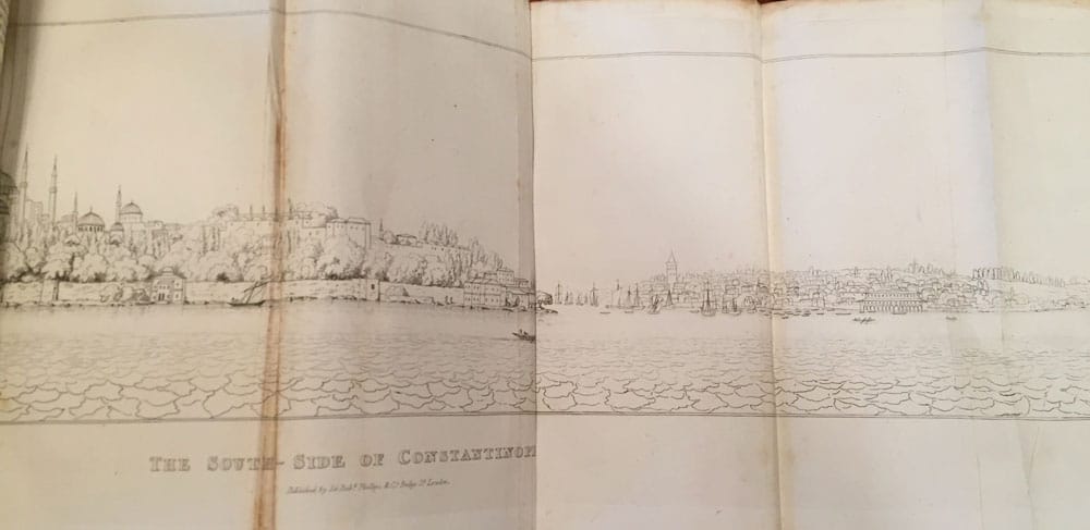
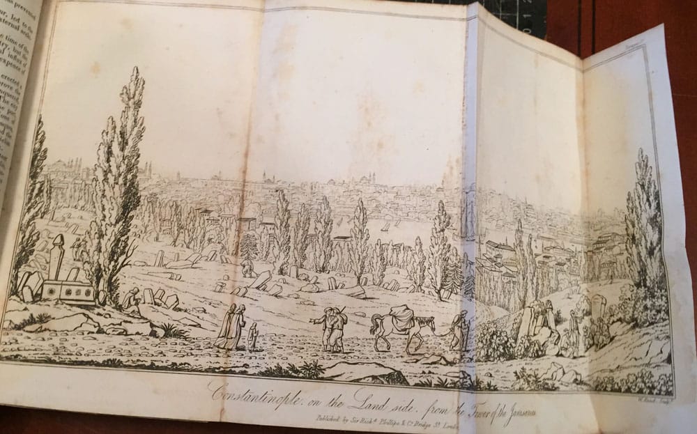
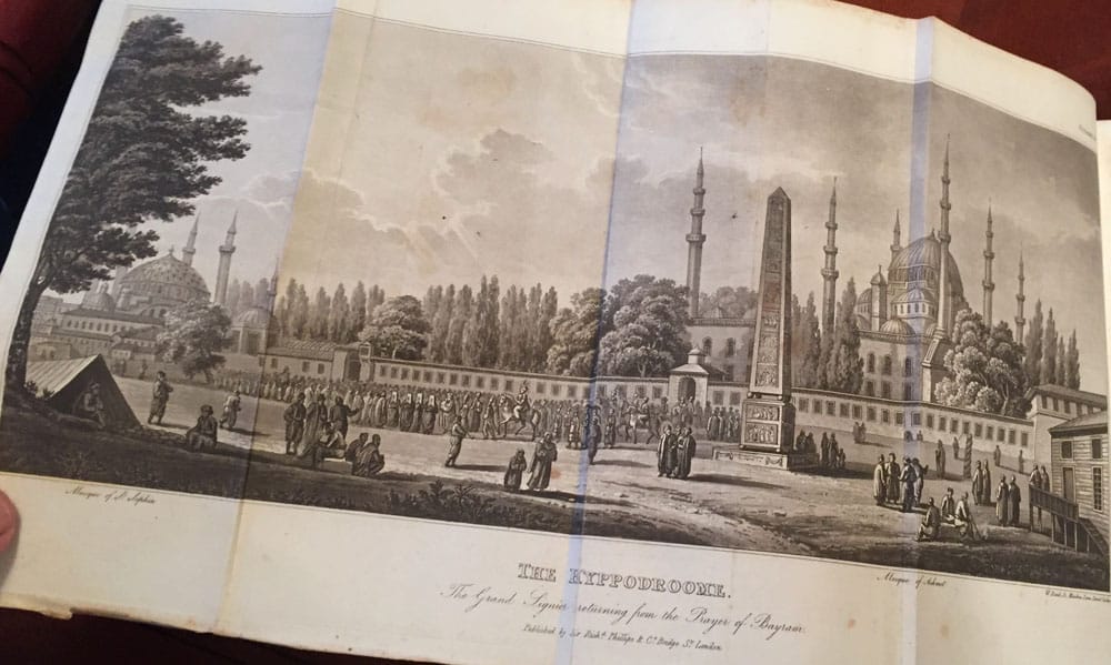
- Picturesque Promenades in and near Constantinople and on the Waters of the Bosphorus. By Charles Pertusier. 1820 Large Fold-Out engraving of the The Hyppodroome, opposite the main title page. Large Fold-Out engraving of the View of Constantinople from the Tower of the Janissaries. Large Fold-Out engraving of The South of Constantinople. And four other full page engravings, one more then the book calls for. 132 pages in total.
2. Travels in Sicily and to Mount Etna in 1819 by M. Gourbillon. 1820 Title-page, with a small engraving of the Cone of Etna, House of Refuge, Philosopher’s Tower. And three other full page engravings, 112 pages in total.
3. Travels in Montenegro; containing a Topographical, Picturesque, and Statistical Account of that hitherto under scribed Country, by Col. L. C. Vialla De Sommiere. 1920;- 8 full page engravings, including the first full page plate is a hand-coloured plate of Cattaro below Montenegro; 108 pages in total.
4. Travels in Epirus, Albania, Macedonia, and Thessaly, by F. C. H. L. Pouqueville, M. D. 1820;- Ali Pacha Vizier of Janana opposite the main title page. And three other engraved plates. 122 pages in total.
5. Journal of the Tour into the Interior of Missouri and Arkansaw, 1818-1819, from Potosi, or Mine a Burton, in Missouri Territory, in South-West Direction, towards the Rocky Mountains, by Henry R. Schoolcraft. Large Fold-Out engraving Map of Missouri and Arkansaw, opposite the main title page.
And the page behind the Fold-Out of Missouri and Arkansaw, is a one page NOTICE. 122 pages in total, including A Poem in 11 pages to the back pages of this section, by Henry R. Schoolcraft, Transallegania, or The Groans of Missouri.
6. Voyage from France to Cochin-China, by Capt. Rey, 1819-1820. Published in 1821. No plates called for.
7. Classical Excursion from Rome to Arpino by Charles Kelsall. 1821;-
First engraved plate is a Large Fold-Out engraving, called Miscellaneous Antiquites. And four more full page engraved plates. 107 pages in total, last pages of this Volume 4 has a Postscript page.

Volume 5.
New Voyages and Travels: Consisting of Originals, Translations 1819-1823. Volume 5.
Price $2,750 Buy Now


New Voyages and Travels: Consisting of Originals, Translations 1819-1823. Volume 5.
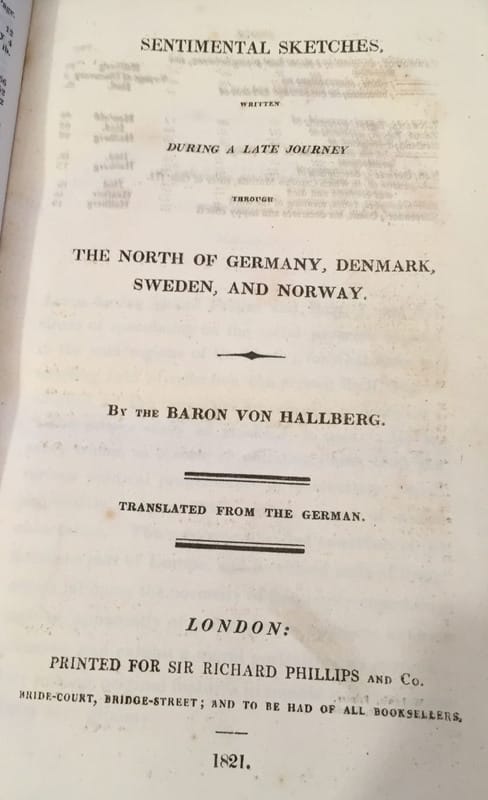
Edited and Published by Sir Richard Phillips. 1820-1823. The 6 books within one, in Volume 5, some have there own title page. This Volume 5 consist of first story.. Sentimental Sketches, The North of Germany, Denmark, Sweden, and Norway, by Baron Von Hallberg. 1821, followed by 5 more travel stories;- New Voyages and Travels: Volume 5. Bound in fine stunning original antique parchment with old hand-written script to front and back of the binding. 28 Engravings within. 6 Voyages and Adventure also within, 20 pages Index to Volume 5 to the first few pages.
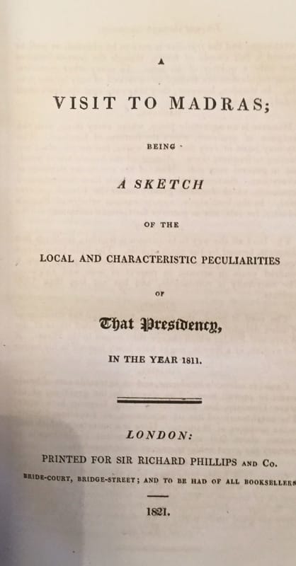
1A. An added Adventure “A visit to Madras : being a Sketch of the local and characteristic peculiarities of That Presidency in the year 1811”. There were no engravings issued to the adventure, 35 pages within the Adventure.
1B. Letters from Africa, by Signor Travideani, or Aveiro, to Canova, the Sculptor. 1818;- There were no engravings issued to the adventure, 11 pages dealing with Letters.
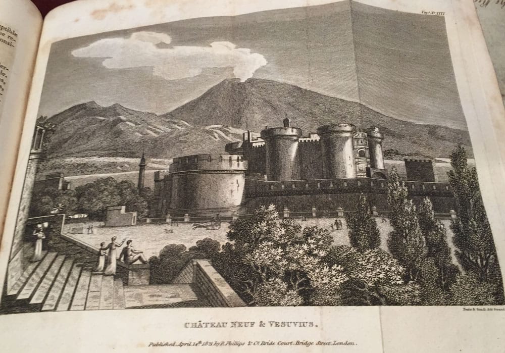
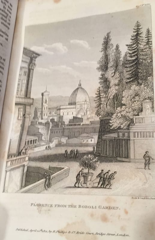
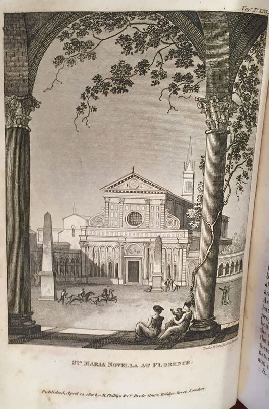
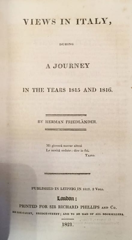
2. Views in Italy, 1815-1816 by Herman Friedlander. 6 engraved full page engravings, including a large Fold-Out of Chateau Nuef and Vesuvius.There were no engravings issued to the adventure, 124 pages within the Adventure of Italy.
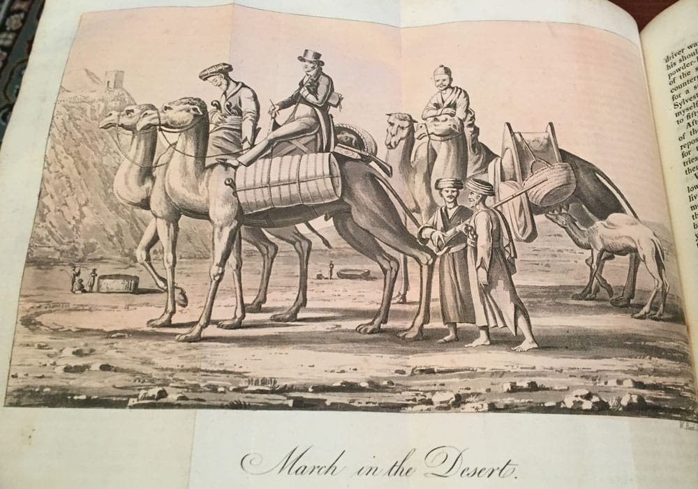
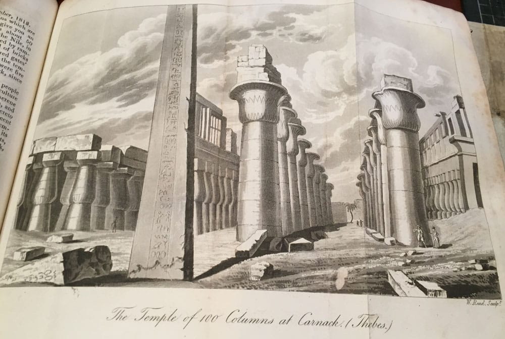
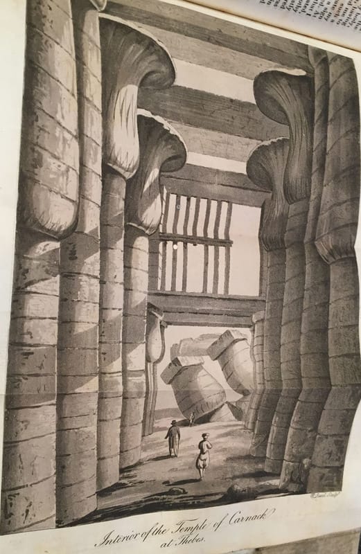
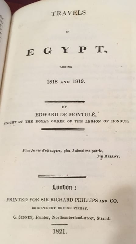
3. Travels in Egypt 1818-1819 by Edward deMontule. 1821;- 10 engraved full page engravings, including 4 large engraved Fold-Outs ;- 1. March in the Desert, Colossus and Palace of Memnon at Thebes, 2. The Temple of 100 Columns at Carnack, at Thebes, 3. Portal of Etfu from Portico. And 4. Interior of the Temple of Carnack, at Thebes. 96 pages within and 20 pages of Notes added to the last pages of this section.
4. Letters written during the late Voyage of Discovery in the Western Artic Sea by an Officer of the Expedition. (The Writer was, Lieutenant William Edward Parry : the Ship was The Griper which was commanded by Lieutenant Matthew Liddon.) 4 full page engravings, first engraved plate is a Chart of Discoveries made by Captain Perry in 1819-1820 North West Passage;- opposite the Title-Page, 1821;- After the first plate is a two page PREFACE. 124 pages within the Adventure.
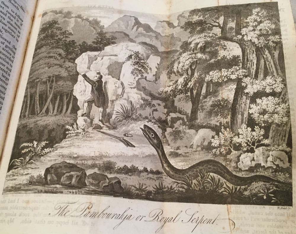
5. Travels on Foot through the Island if Ceylon by J. Haafner. 1821;- 3 full page engravings, 2 are large fold-out engravings. Rencontre with a Bear, and the other fold-out plate is The Pambon-Rajah, or Royal Serpent. 118 pages with the Adventure section.
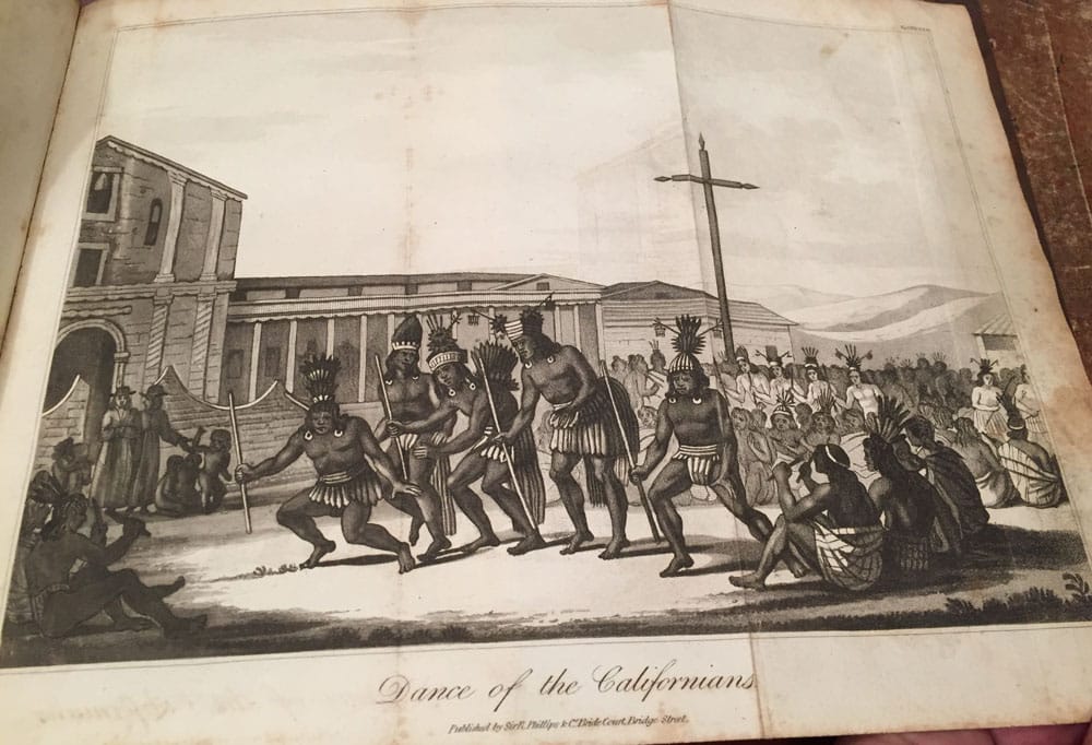
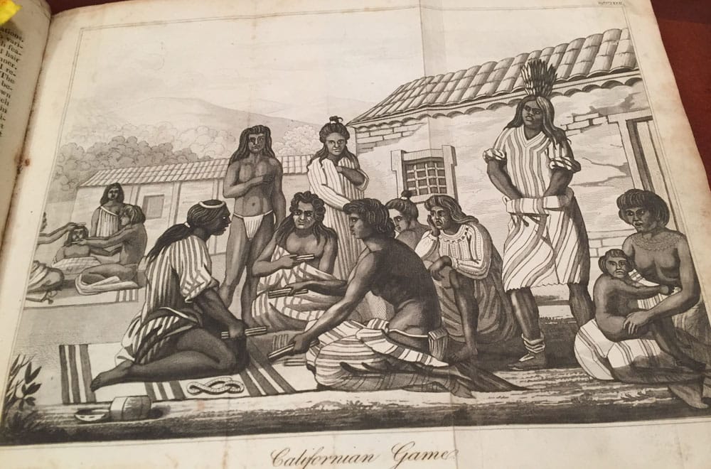
6. A Voyage to North America and the West Indies by Edward deMontule.
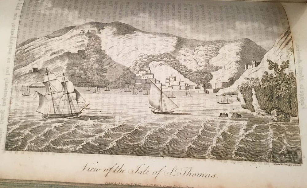
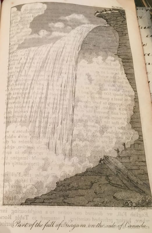
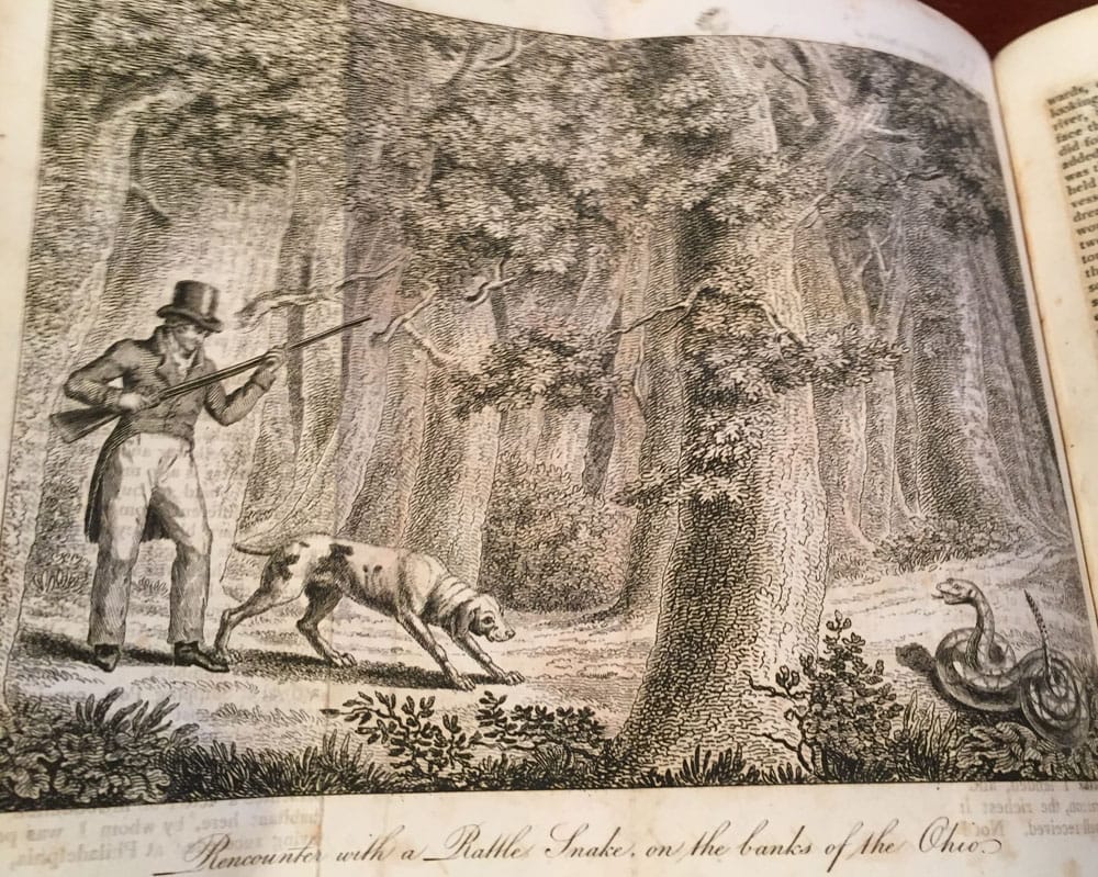
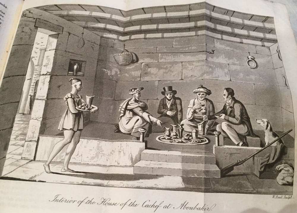
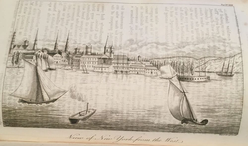
1821;- 5 engraved full page engraved plates within. 3 are large fold-out plates 1. Sketch of a Mammoth in the Museum in Philadelphia, 2. Interior of the House of the Cachef at Aboubakir;- (this fold out-plate is not listed in the list of engraving in Volume 5) 3. Rencounter with a Rattle Snake on the banks of the Ohio. Also (this fold out-plate is not listed in the list of engraving in Volume 5). Also a small woodcut with text of Tomb on the banks of the Ohio. Another small woodcut with text of Steam-Boat on the Mississippi. And Another small woodcut with text of The Mansion, or Town House, at Philadelphia. And Another small woodcut with text of The Hospital at Philadelphia. The other 4 full page engraves listed are ;- 1. Part of the Fall of Niagara on the side of Canada. 2. Entrance of the Port of St. Domingo. 3. View of the Island of St. Thomas. 4. View of New York City from the West. 102 pages brings the book to an end.
Edited and Published by Sir Richard Phillips. 1820-1823. The 6 books within one, in Volume 5, some have there own title page. This Volume 5 consist of first story.. Sentimental Sketches, The North of Germany, Denmark, Sweden, and Norway, by Baron Von Hallberg. 1821, followed by 5 more travel stories;- New Voyages and Travels: Volume 5. Bound in fine stunning original antique parchment with old hand-written script to front and back of the binding. 28 Engravings within. 6 Voyages and Adventure also within, 20 pages Index to Volume 5 to the first few pages.
- Sentimental Sketches, a late Journey through The North of Germany, Denmark, Sweden, and Norway, by Baron Von Hallberg. There were no engravings issued to the adventure, 74 pages within the Adventure.
1A. An added Adventure “A visit to Madras : being a Sketch of the local and characteristic peculiarities of That Presidency in the year 1811”. There were no engravings issued to the adventure, 35 pages within the Adventure.
1B. Letters from Africa, by Signor Travideani, or Aveiro, to Canova, the Sculptor. 1818;- There were no engravings issued to the adventure, 11 pages dealing with Letters.
2. Views in Italy, 1815-1816 by Herman Friedlander. 6 engraved full page engravings, including a large Fold-Out of Chateau Nuef and Vesuvius.There were no engravings issued to the adventure, 124 pages within the Adventure of Italy.
3. Travels in Egypt 1818-1819 by Edward deMontule. 1821;- 10 engraved full page engravings, including 4 large engraved Fold-Outs ;- 1. March in the Desert, Colossus and Palace of Memnon at Thebes, 2. The Temple of 100 Columns at Carnack, at Thebes, 3. Portal of Etfu from Portico. And 4. Interior of the Temple of Carnack, at Thebes. 96 pages within and 20 pages of Notes added to the last pages of this section.
4. Letters written during the late Voyage of Discovery in the Western Artic Sea by an Officer of the Expedition. (The Writer was, Lieutenant William Edward Parry : the Ship was The Griper which was commanded by Lieutenant Matthew Liddon.) 4 full page engravings, first engraved plate is a Chart of Discoveries made by Captain Perry in 1819-1820 North West Passage;- opposite the Title-Page, 1821;- After the first plate is a two page PREFACE. 124 pages within the Adventure.
5. Travels on Foot through the Island if Ceylon by J. Haafner. 1821;- 3 full page engravings, 2 are large fold-out engravings. Rencontre with a Bear, and the other fold-out plate is The Pambon-Rajah, or Royal Serpent. 118 pages with the Adventure section.
6. A Voyage to North America and the West Indies by Edward deMontule.
1821;- 5 engraved full page engraved plates within. 3 are large fold-out plates 1. Sketch of a Mammoth in the Museum in Philadelphia, 2. Interior of the House of the Cachef at Aboubakir;- (this fold out-plate is not listed in the list of engraving in Volume 5) 3. Rencounter with a Rattle Snake on the banks of the Ohio. Also (this fold out-plate is not listed in the list of engraving in Volume 5). Also a small woodcut with text of Tomb on the banks of the Ohio. Another small woodcut with text of Steam-Boat on the Mississippi. And Another small woodcut with text of The Mansion, or Town House, at Philadelphia. And Another small woodcut with text of The Hospital at Philadelphia. The other 4 full page engraves listed are ;- 1. Part of the Fall of Niagara on the side of Canada. 2. Entrance of the Port of St. Domingo. 3. View of the Island of St. Thomas. 4. View of New York City from the West. 102 pages brings the book to an end.


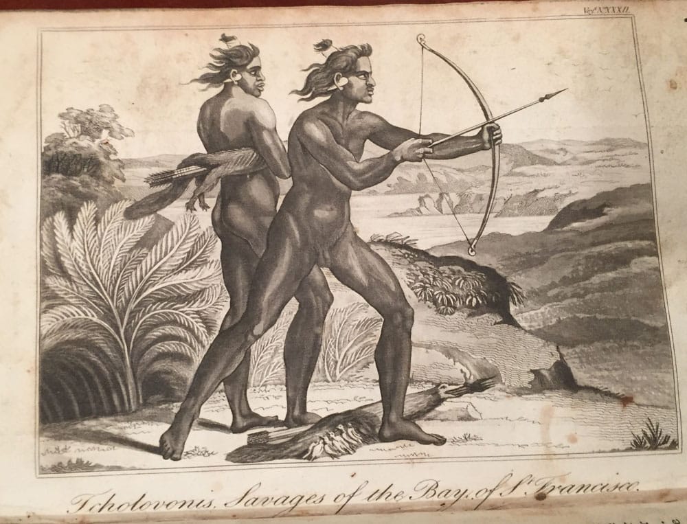
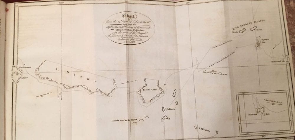
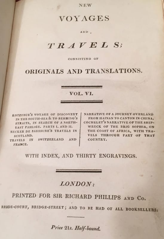
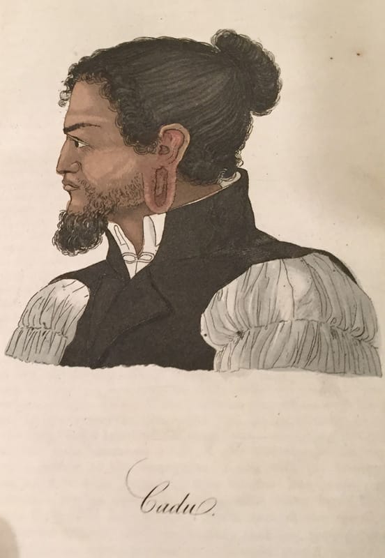
Volume 6.
|
|


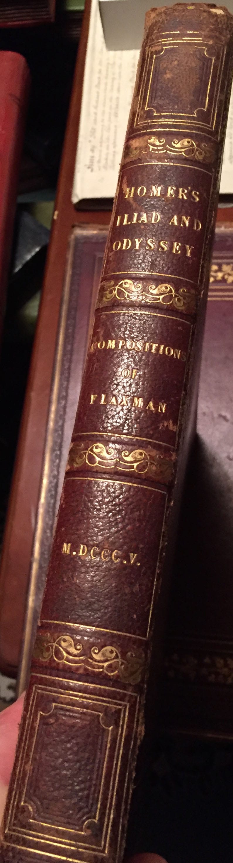
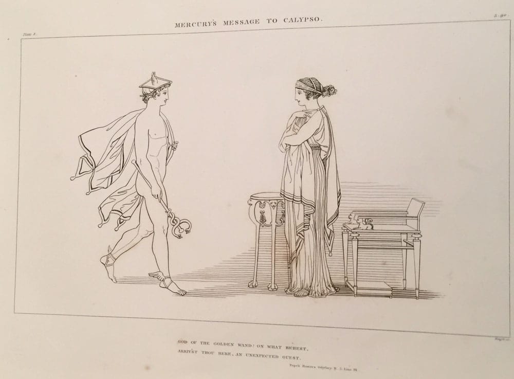
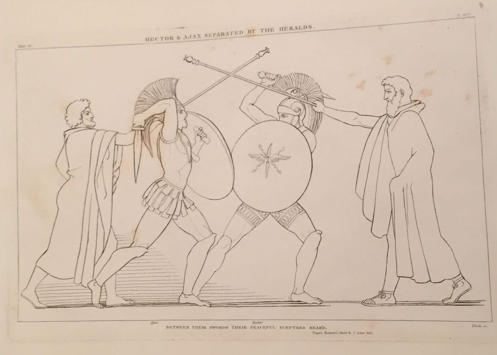
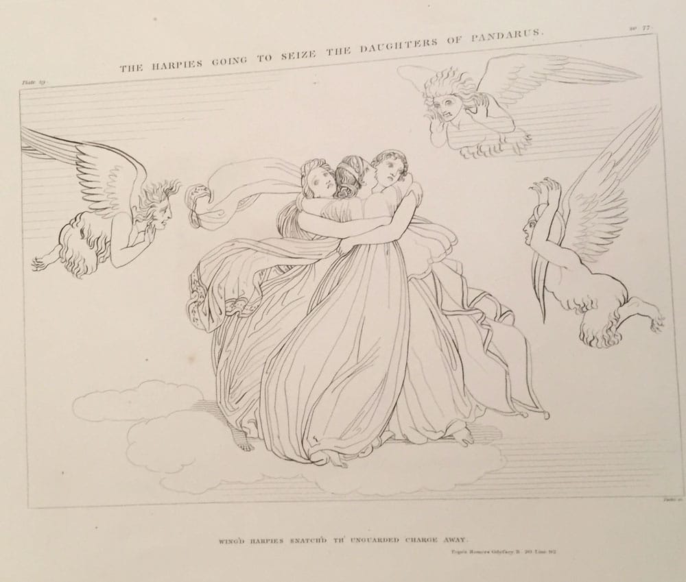
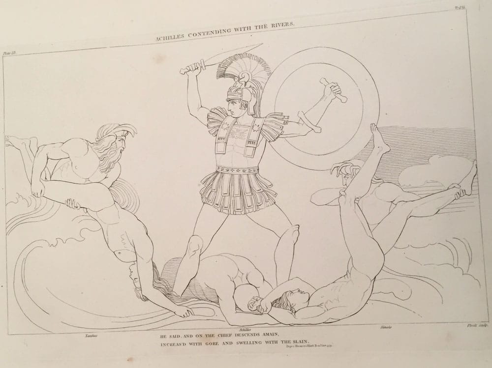
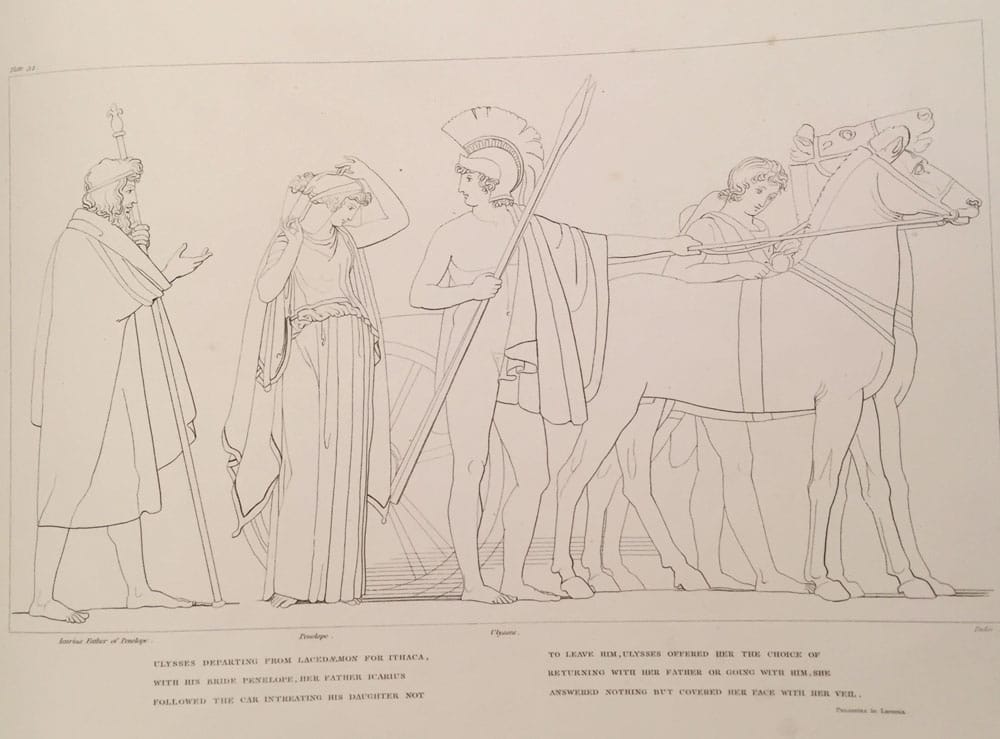
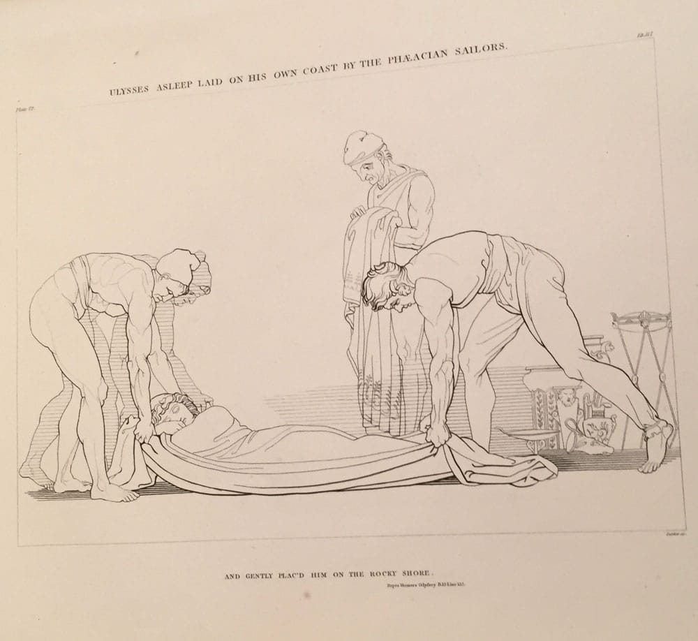
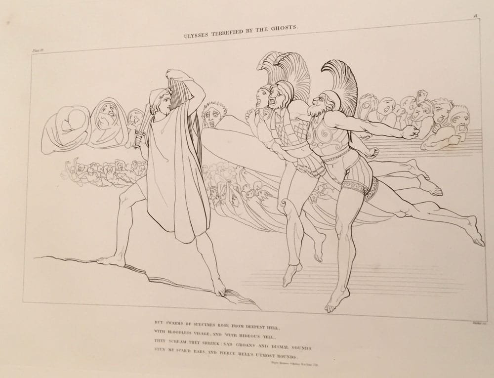
Compositions from the Works, Days, And Theogony of Hesiod;- by John Flaxman, William Blake;-
|
|
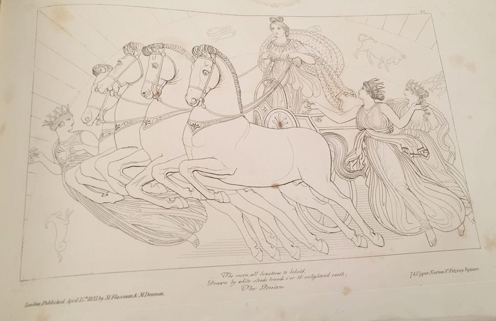
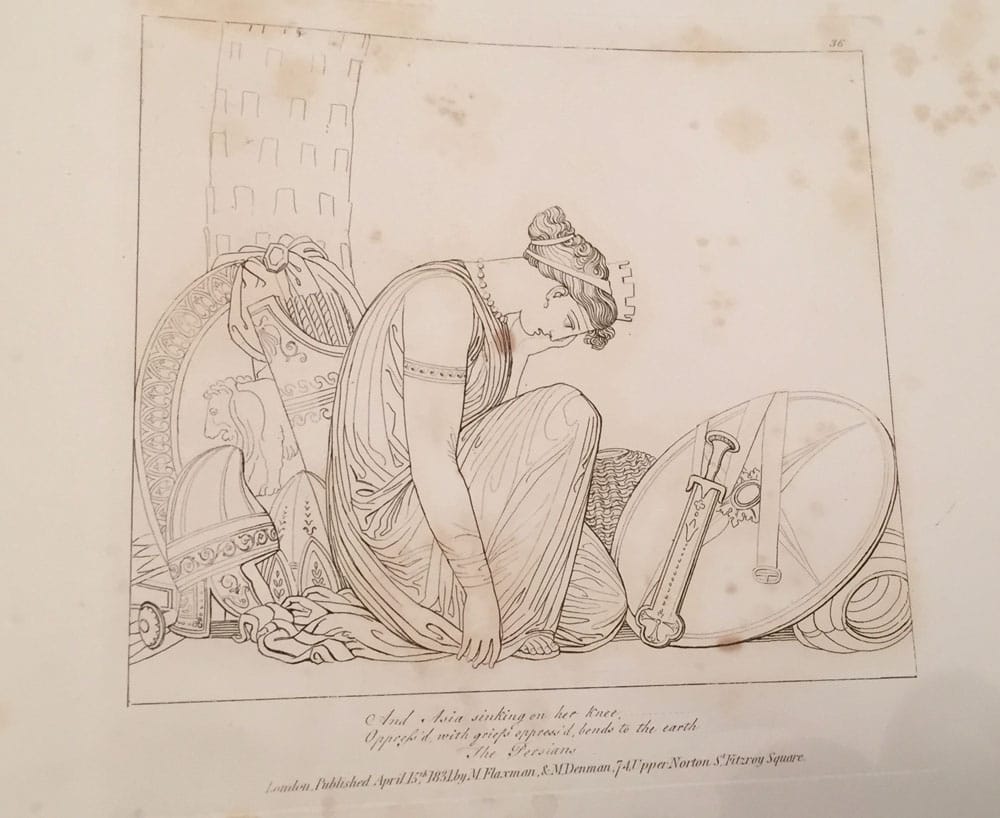
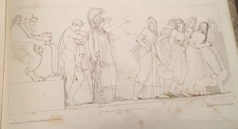
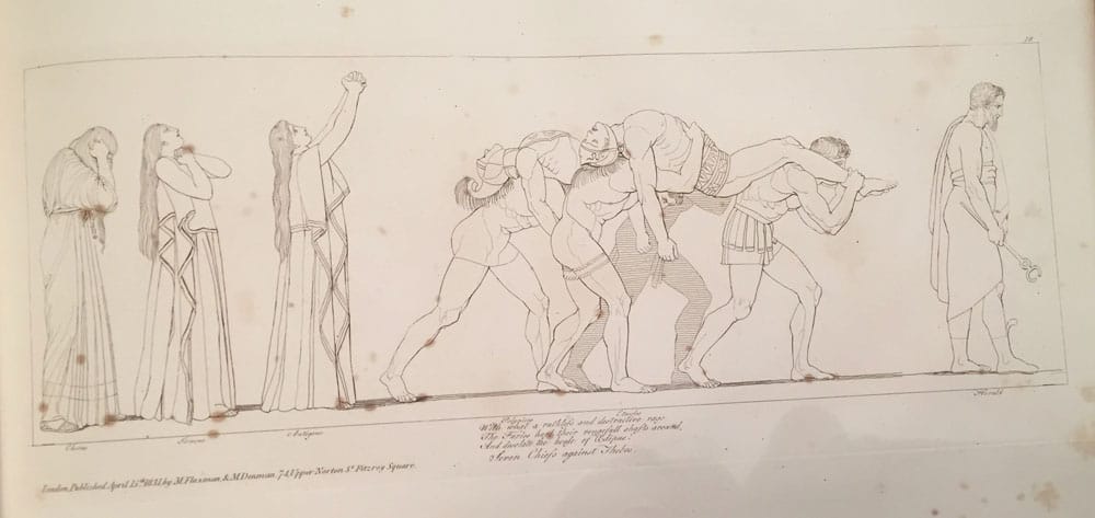

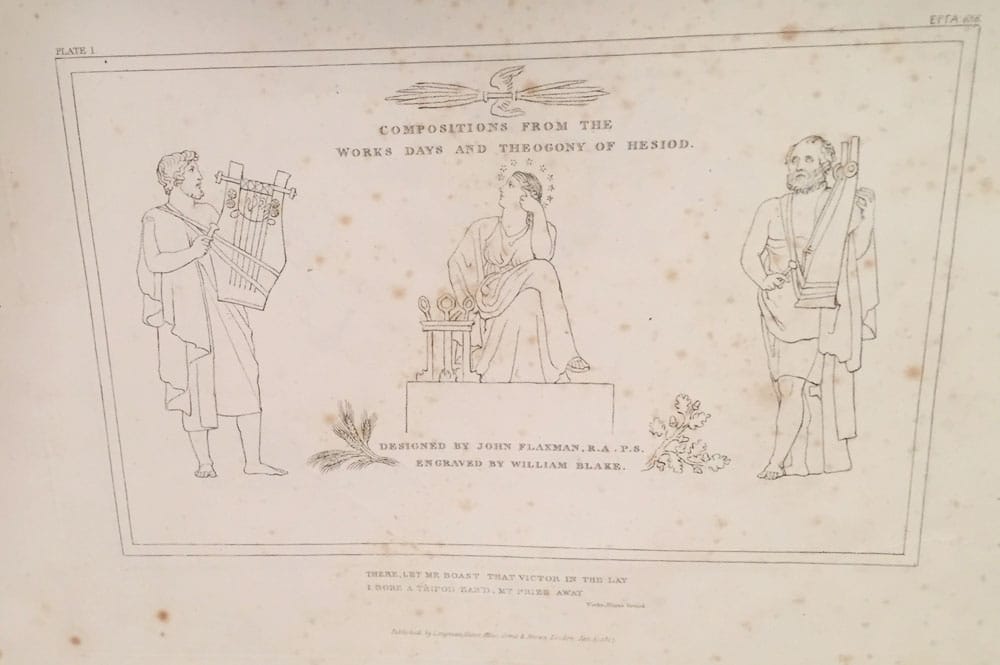

John Flaxman, William Blake;-
|
|
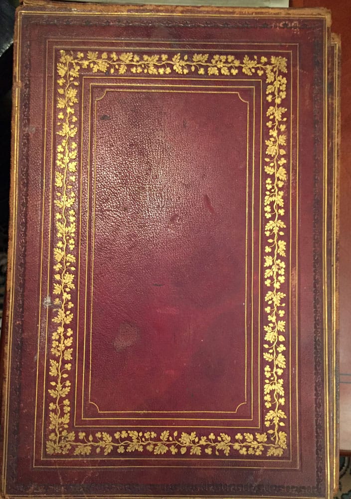
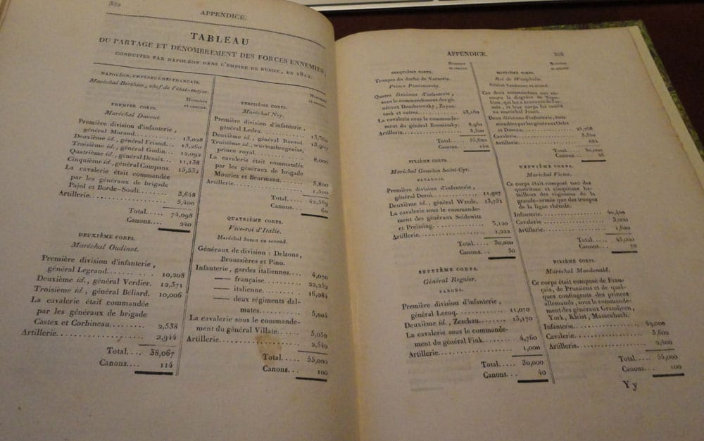
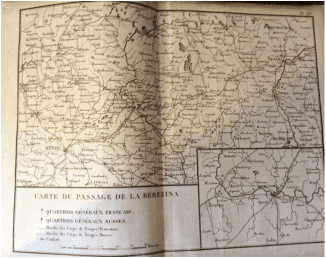
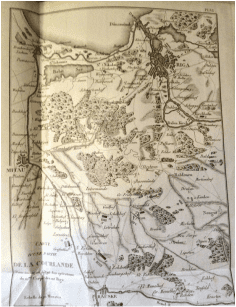
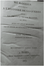
Mémoires pour servir a L’Histoire de la Guerre entre la France et la Russie, en 1812; Avec un Atlas Militaire. Par un Officier
|
|

James Rennell;-
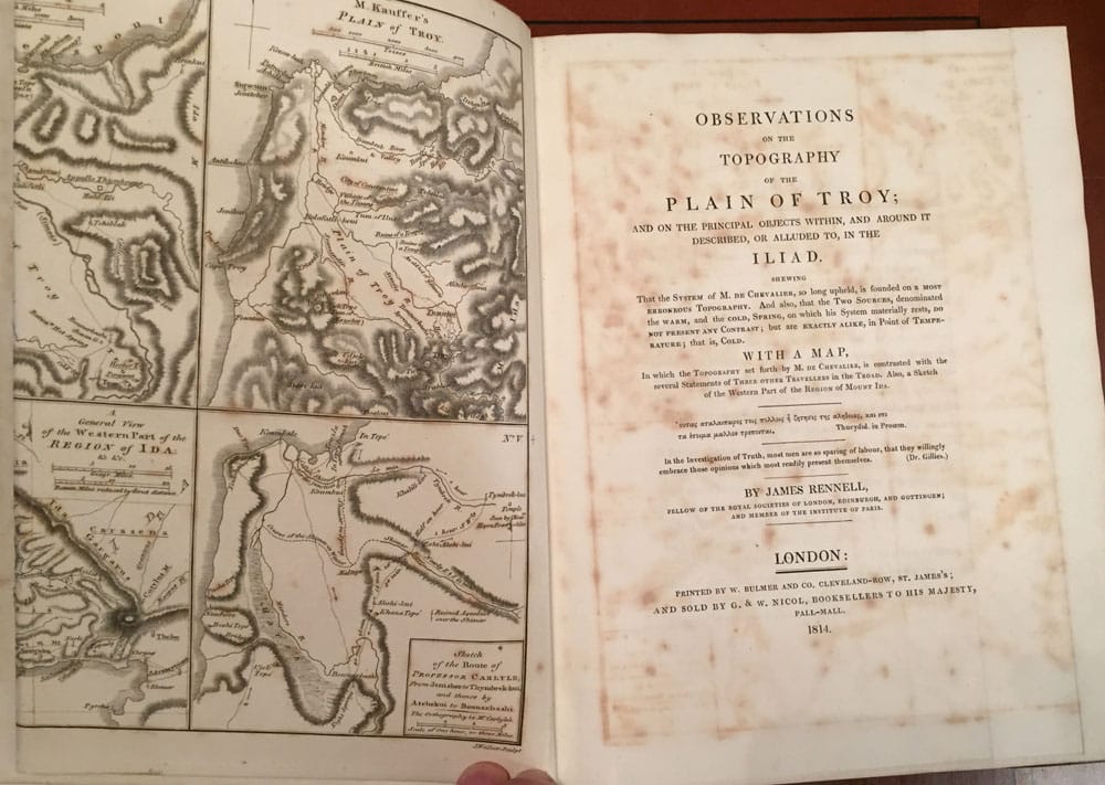
Observations on the Topography of the Plain of Troy, and on the Principal Objects Within and Around It Described or Alluded to in the
Iliad. Shewing ... Is Founded on a Most Erroneous Topography. 1814.
Price $2000 Buy Now
Observations on the Topography of the Plain of Troy, and on the Principal Objects Within and Around It Described or Alluded to in the
Iliad. Shewing ... Is Founded on a Most Erroneous Topography. 1814.
Price $2000 Buy Now


James Rennell;-
Observations on the Topography of the Plain of Troy, and on the Principal Objects Within and Around It Described or Alluded to in the Iliad. Shewing ... Is Founded on a Most Erroneous Topography. 1814.
Published by W. Bulmer 1814;- in London;- 1st. Edition with a very large folding Map as the frontispiece, opposite the title-page, and in fine condition. Original three quarter dark brown leather binding with brown marbled paper to the covers, back and front;- The brown lather to the spine and covers is spotted with foxing. Gilt lettering to the top of the spine. Some slight foxing, to the title-page otherwise a highly collectable book. Opening cover has the book-plate and image of one, His Most Gracious Majesty, George-Augustus-Frederick, The Fourth. The very large fold-out map is The Topography of the Road from the Observations of Mess. Gell, Kauffer, and Carlyle; Mr. Gell being the basis. Observations on the Topography of the Plain of Troy And on the Principal Objects Within, and Around It Described, Or Alluded To, In the Iliad. That the System of M. De Chevalier, so long upheld, is founded on a most erroneous typography, and also, that the Two Sources, denominated the Warm, and the Cold, Spring, on which his System materially rests, Do Not Present Any Contrast; but are Exactly Alike, In Point of Temperature; that is, Cold. With a map. In Which the Topography Set Forth by M. De Chevalier, is contrasted with the several Statements of Three other Travellers in the Troad. Also, a Sketch of the Western Part of the Region of Mount Ida. Errata page is xxii to the front pages, 3 page of an Addenda to the last few pages before the Index, which has the 6 last pages. The book is very clean, free of notes or creasings throughout
Major James Rennell, was an English cartographer, adventurer and was considered the Father of Oceanography. James Rennell could also be claimed as the Father of historical geography. After a long career at sea and in India, during which he had learned surveying and cartography, he returned to England and entered the circle of Sir Joseph Banks, who encouraged him to widen his interests to include the geography of the ancient world. In this work, published in 1814, Rennell compares the actual topography of the area in which Troy was believed to be located with the accounts of ancient commentators on Homer, with the Homeric accounts themselves, and finally with the work of ancient geographers. Without offering his own solution to the problem, he demolishes with zest the then current theory that Troy was located at the village of Bournabashi, a conclusion with which Heinrich Schliemann later agreed.
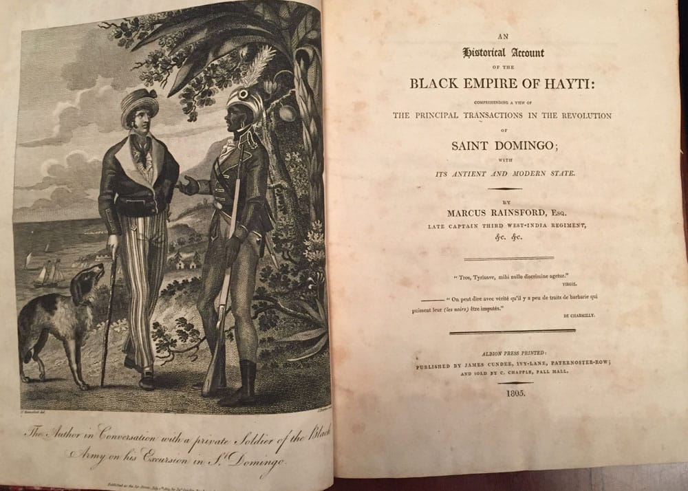
Marcus Rainsford;
An Historical Account of the Black Empire of Hayti:
Comprehending a View of the Principal Transactions in the Revolution of Saint Domingo; with Its Ancient and Modern State.
Price $ 2,500 Buy Now.
An Historical Account of the Black Empire of Hayti:
Comprehending a View of the Principal Transactions in the Revolution of Saint Domingo; with Its Ancient and Modern State.
Price $ 2,500 Buy Now.

Marcus Rainsford;
An Historical Account of the Black Empire of Hayti:
Comprehending a View of the Principal Transactions in the Revolution of Saint Domingo; with Its Antient and Modern State.
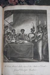
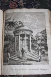
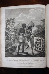
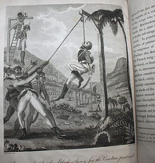
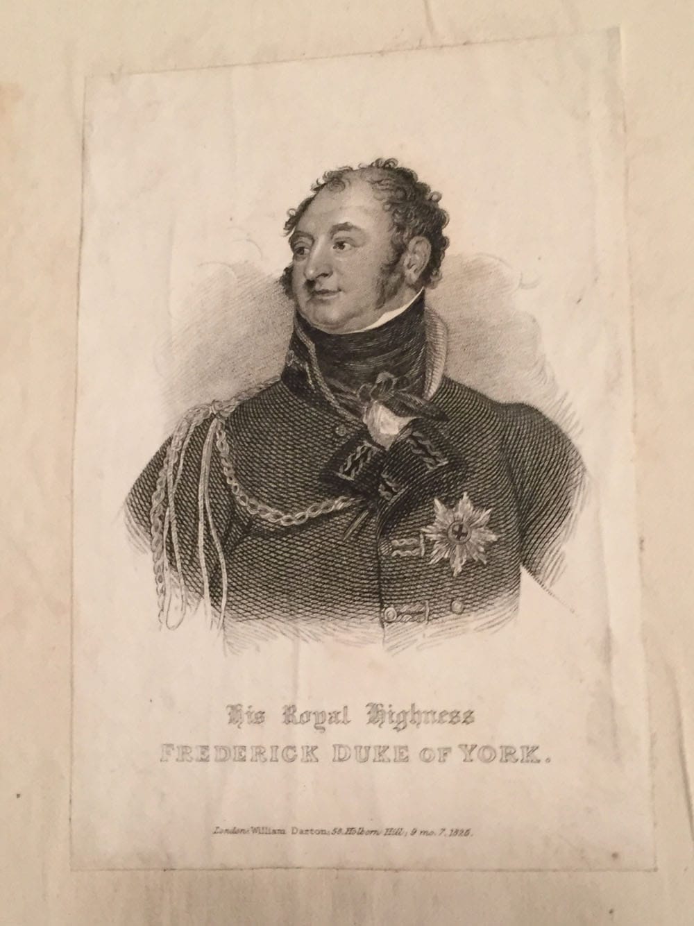
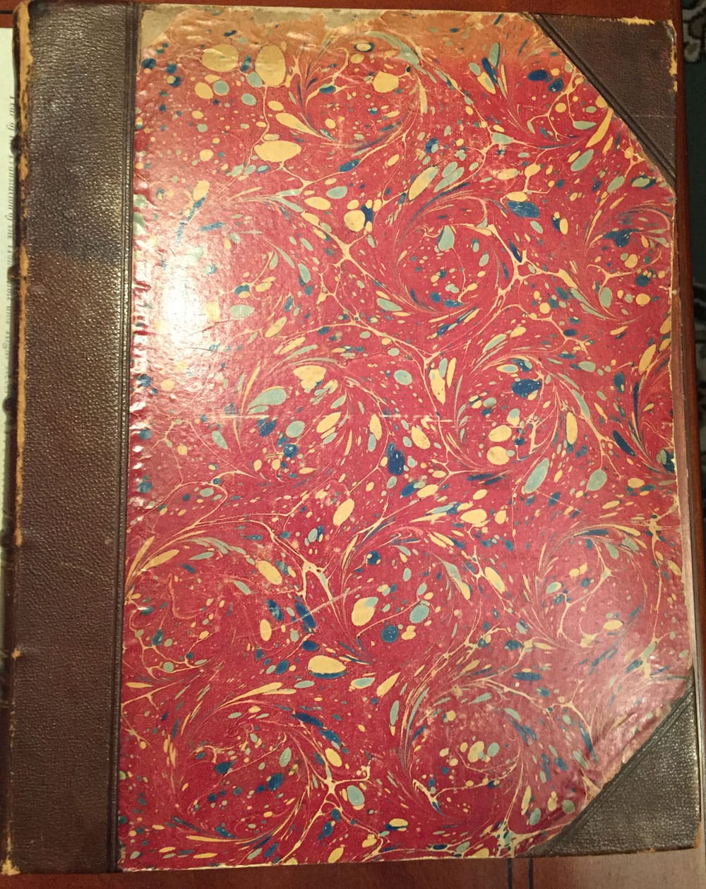
Published in London: Albion Press : Published by James Cundee, 1805. 1st. Edition. Original three quarter brown leather binding with red marbled paper covers, the covers are warped, slightly curved, but original;- Book plate of one His Royal Highness, Frederick Duke of York , inside front cover. Ads of the publisher's to the back pages. 11 plates as called for at the back of book are present;- Frontispiece and engraved plates by J. Barlow after drawings by the author, letter facsimile, Fold-out Map of the island of St. Domingo, Fold-out Plan of the City of Cape Francois as it existed before the revolution. Includes A Succinct historical View of the Colonies of Hispaniola and St. Domingo, Origin of the Revolutionary Spirit of this Period in St. Domingo, Account of the Progress and Accomplishment of the Independence of St. Domingo, State of Manners on the Independence of the Blacks in St. Domingo, View of the Black Army, and of the War between the French Republic and the Independent Blacks of St. Domingo, On the Establishment of a Black Empire, the Black Army, a very particular military force, created for the sole purpose of the Revolution-, both in very particular attires, a map of Santo Domingo, a plan of the city of the French Cape and nine plates with military and costumes views, some folding-, made by J. Barlow after the drawings of the Author. Of particular interest, is one engraved plate entitled ‘The Mode of exterminating the Black Army’, as practiced by the French, showing a French soldier about to strike a soldier of the Black Army over a boat and members of the Black Army being destroyed by dogs in the water. Ostensibly a history of the Islands of Hispaniola and Santo Domingo, from their discovery by the Spanish until 1789, including the relations of the religious revolution, the independence of the natives and the black slaves from Africa, the Black Armada and the war with the French Republic. This is a very Rare/Scarce book, in good condition;- The Original Binding is not perfect, but is original;- Scarce/Rare;-
An Historical Account of the Black Empire of Hayti:
Comprehending a View of the Principal Transactions in the Revolution of Saint Domingo; with Its Antient and Modern State.
Published in London: Albion Press : Published by James Cundee, 1805. 1st. Edition. Original three quarter brown leather binding with red marbled paper covers, the covers are warped, slightly curved, but original;- Book plate of one His Royal Highness, Frederick Duke of York , inside front cover. Ads of the publisher's to the back pages. 11 plates as called for at the back of book are present;- Frontispiece and engraved plates by J. Barlow after drawings by the author, letter facsimile, Fold-out Map of the island of St. Domingo, Fold-out Plan of the City of Cape Francois as it existed before the revolution. Includes A Succinct historical View of the Colonies of Hispaniola and St. Domingo, Origin of the Revolutionary Spirit of this Period in St. Domingo, Account of the Progress and Accomplishment of the Independence of St. Domingo, State of Manners on the Independence of the Blacks in St. Domingo, View of the Black Army, and of the War between the French Republic and the Independent Blacks of St. Domingo, On the Establishment of a Black Empire, the Black Army, a very particular military force, created for the sole purpose of the Revolution-, both in very particular attires, a map of Santo Domingo, a plan of the city of the French Cape and nine plates with military and costumes views, some folding-, made by J. Barlow after the drawings of the Author. Of particular interest, is one engraved plate entitled ‘The Mode of exterminating the Black Army’, as practiced by the French, showing a French soldier about to strike a soldier of the Black Army over a boat and members of the Black Army being destroyed by dogs in the water. Ostensibly a history of the Islands of Hispaniola and Santo Domingo, from their discovery by the Spanish until 1789, including the relations of the religious revolution, the independence of the natives and the black slaves from Africa, the Black Armada and the war with the French Republic. This is a very Rare/Scarce book, in good condition;- The Original Binding is not perfect, but is original;- Scarce/Rare;-
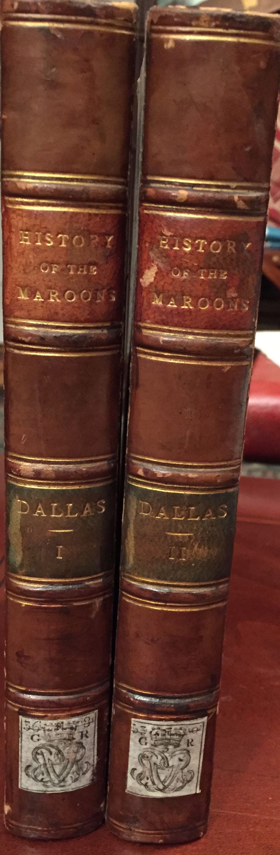
Dallas, R. C. (Robert Charles)
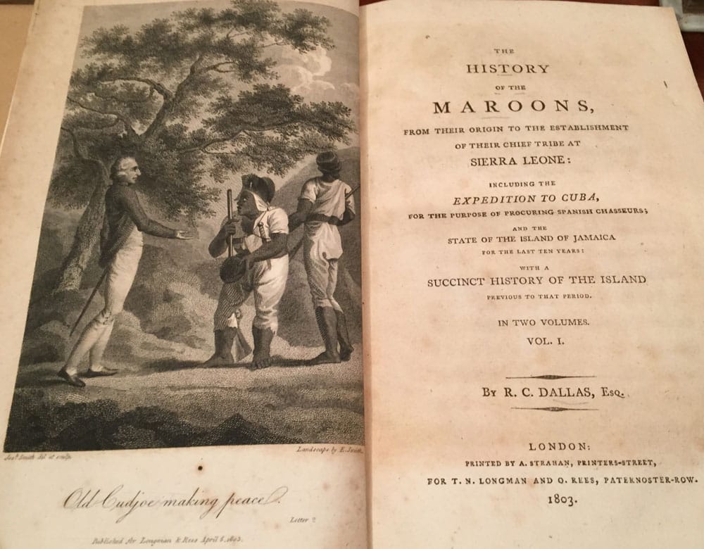
The History of the Maroons, 1803
Price $2,750 Buy Now
The History of the Maroons, 1803
Price $2,750 Buy Now

Dallas, R. C. (Robert Charles)
The History of the Maroons, from their origin to the establishment of their chief tribe at Sierra Leone, including the expedition to Cuba, for the purpose of procuring Spanish Chasseurs and the state of the island of Jamaica for the last ten years, with a succinct history of the island previous to that period;- 1803
Published in London: by A. Strahan for T.N. Longman and O. Rees. 1803 - 2 Volume;- 2 Fold-out Maps;-1st. Edition;- Original three quarter brown leather bindings and marbled paper cover. Gilt lettering and decorations to the both spines.
Volume 1. Frontispiece;- 1. Old Cudjoe making Peace,
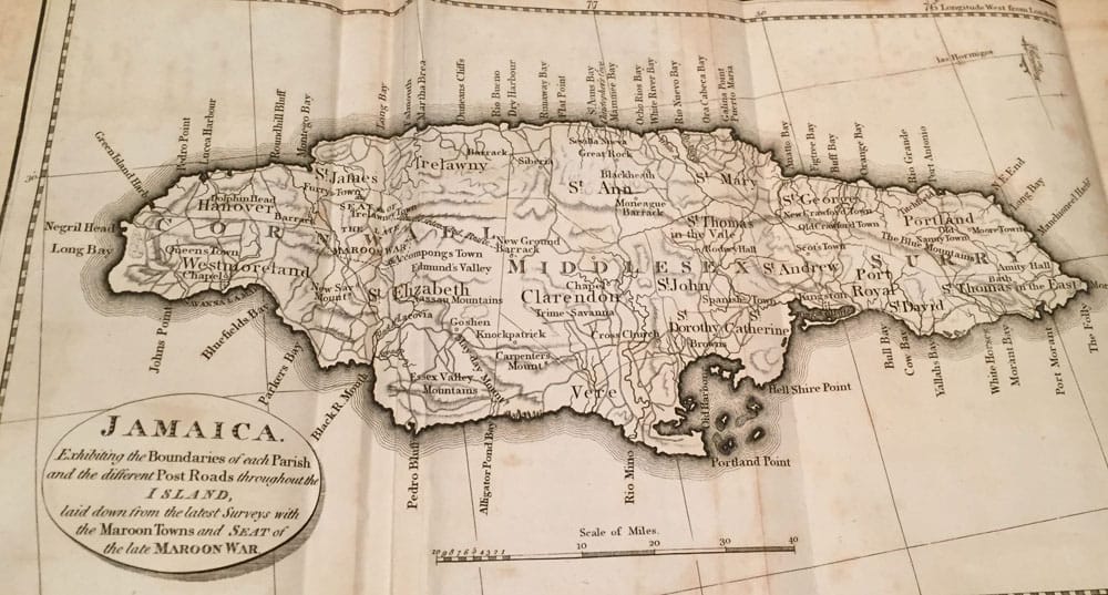
2. A very large fold-out Map of Jamaica;-
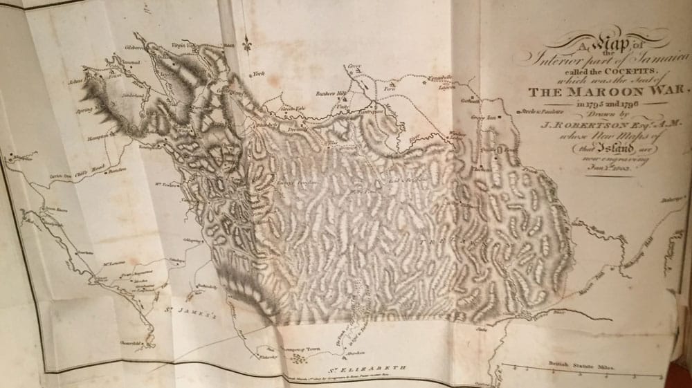
3. A very large fold-out Map, The Seat of the Maroon War,
359 pages to volume 1.
Volume 2. Frontispiece;- 1. A Caffeur of the Island of Cuba,
514 page in total to volume 2.
This is an account of the runaway slaves of the Spanish in 18th century Jamaica and their struggles for independence under the British. These 2 volumes contain a brief history of Jamaica under Spanish rule; its conquest by Britain; the Earl of Belcarres and other early administrators; the origin of the Maroons; Juan de Bolas and the Clarendon rebels; the Maroon chief Cudjoe and his activities during the 1730's fighting; the 1739 treaty between the British and the Maroons; origins of the Second Maroon War in the 1790's; declaration of martial law; burning of Maroon towns; progress of the war under General Walpole; Maroon raids on British planters; the use of Cuban attack dogs on the natives; the Maroons' surrender and terms of the peace; and much more. An appendix at the end prints legislation regarding slavery, votes of the Jamaican assembly, and legal depositions of Maroon prisoners and British natives. There is an engraved frontispiece of a Cuban "chasseur" (dog-handler) and two folding maps- one of Jamaica and the other of the Cock-Pits area in the interior of Jamaica where the Second Maroon War was fought. Errata page to the last page of volume 2, and the final back page of volume 2 is an Ad for Lately Published by T. N. Longman and O. Rees. Highly collectable books, in fine condition, with the fold-out maps in fine condition; Rare/Scarce.
The History of the Maroons, from their origin to the establishment of their chief tribe at Sierra Leone, including the expedition to Cuba, for the purpose of procuring Spanish Chasseurs and the state of the island of Jamaica for the last ten years, with a succinct history of the island previous to that period;- 1803
Published in London: by A. Strahan for T.N. Longman and O. Rees. 1803 - 2 Volume;- 2 Fold-out Maps;-1st. Edition;- Original three quarter brown leather bindings and marbled paper cover. Gilt lettering and decorations to the both spines.
Volume 1. Frontispiece;- 1. Old Cudjoe making Peace,
2. A very large fold-out Map of Jamaica;-
3. A very large fold-out Map, The Seat of the Maroon War,
359 pages to volume 1.
Volume 2. Frontispiece;- 1. A Caffeur of the Island of Cuba,
514 page in total to volume 2.
This is an account of the runaway slaves of the Spanish in 18th century Jamaica and their struggles for independence under the British. These 2 volumes contain a brief history of Jamaica under Spanish rule; its conquest by Britain; the Earl of Belcarres and other early administrators; the origin of the Maroons; Juan de Bolas and the Clarendon rebels; the Maroon chief Cudjoe and his activities during the 1730's fighting; the 1739 treaty between the British and the Maroons; origins of the Second Maroon War in the 1790's; declaration of martial law; burning of Maroon towns; progress of the war under General Walpole; Maroon raids on British planters; the use of Cuban attack dogs on the natives; the Maroons' surrender and terms of the peace; and much more. An appendix at the end prints legislation regarding slavery, votes of the Jamaican assembly, and legal depositions of Maroon prisoners and British natives. There is an engraved frontispiece of a Cuban "chasseur" (dog-handler) and two folding maps- one of Jamaica and the other of the Cock-Pits area in the interior of Jamaica where the Second Maroon War was fought. Errata page to the last page of volume 2, and the final back page of volume 2 is an Ad for Lately Published by T. N. Longman and O. Rees. Highly collectable books, in fine condition, with the fold-out maps in fine condition; Rare/Scarce.
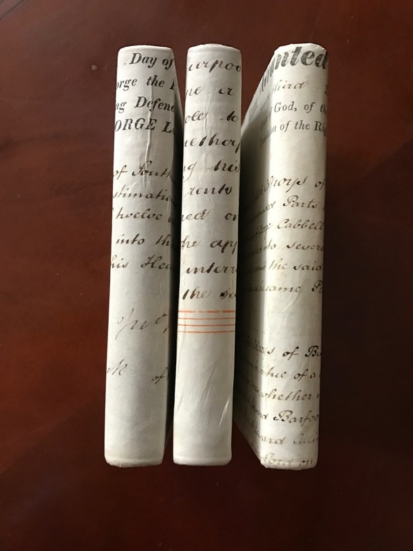
Richard and John Lander:
Journal of an Expedition to Explore the Course and Termination of the Niger;
Price $3,500 Buy Now
Journal of an Expedition to Explore the Course and Termination of the Niger;
Price $3,500 Buy Now
Richard and John Lander:
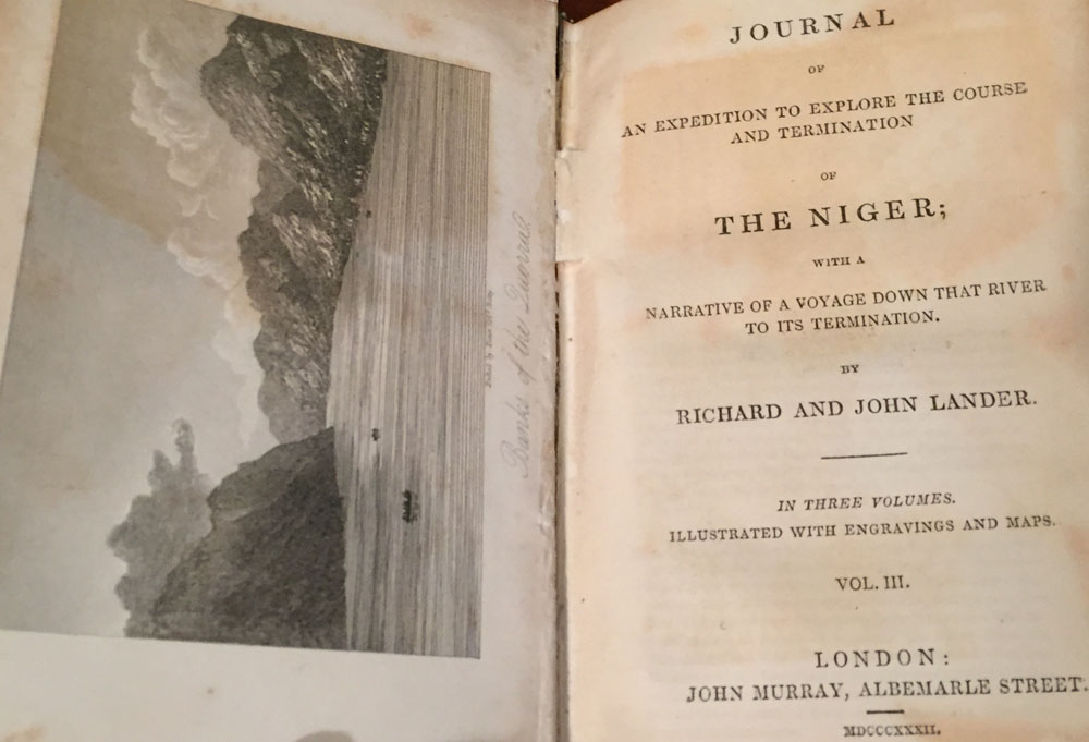
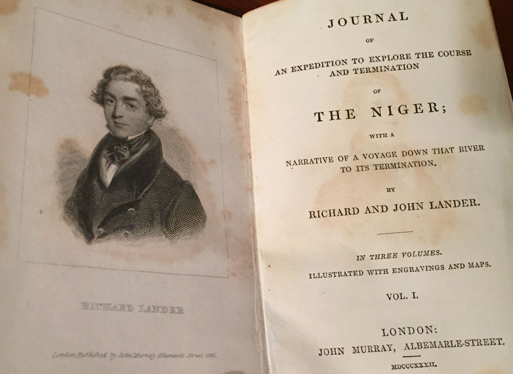
Journal of an Expedition to Explore the Course and Termination of the Niger; with a narrative of a voyage down that river to its termination.
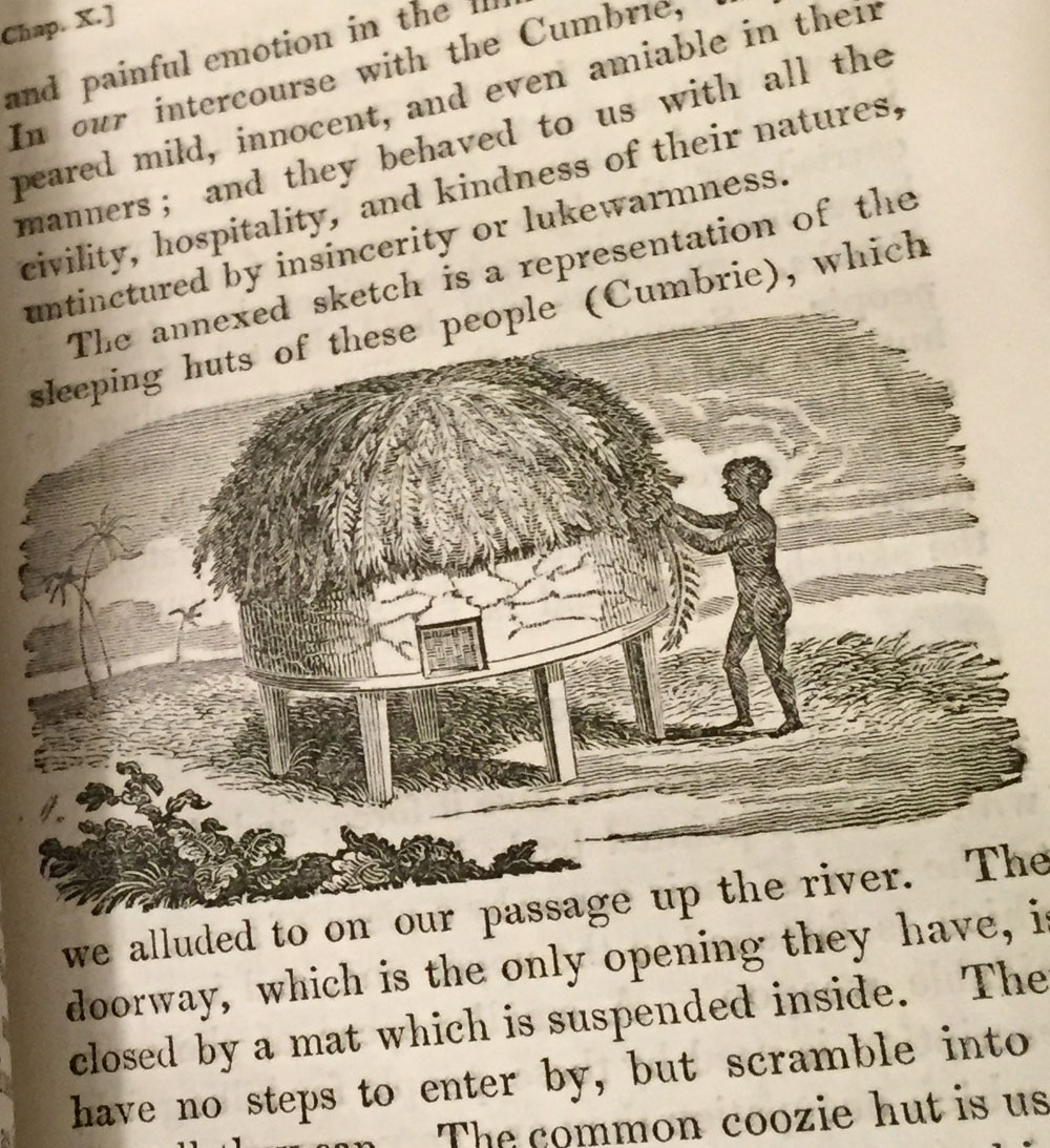
The 3 Volumes Set is small and was Published in London, in 1832:- by John Murray;- A true 1st. Edition with 9 Engravings including two maps, one very large fold-out map, and numerous small woodcuts throughout the 3 volumes as called for.
All 3 volumes have a frontispiece, opposite the three title pages ;-
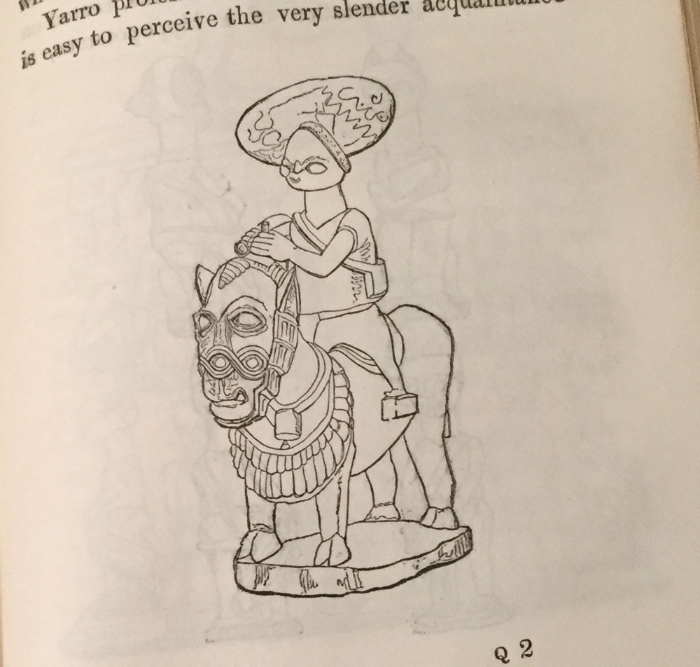
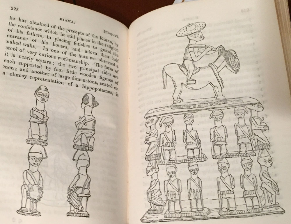
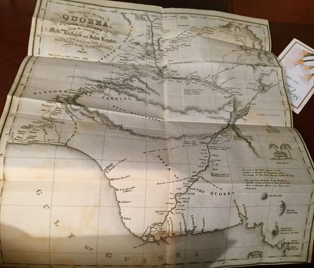
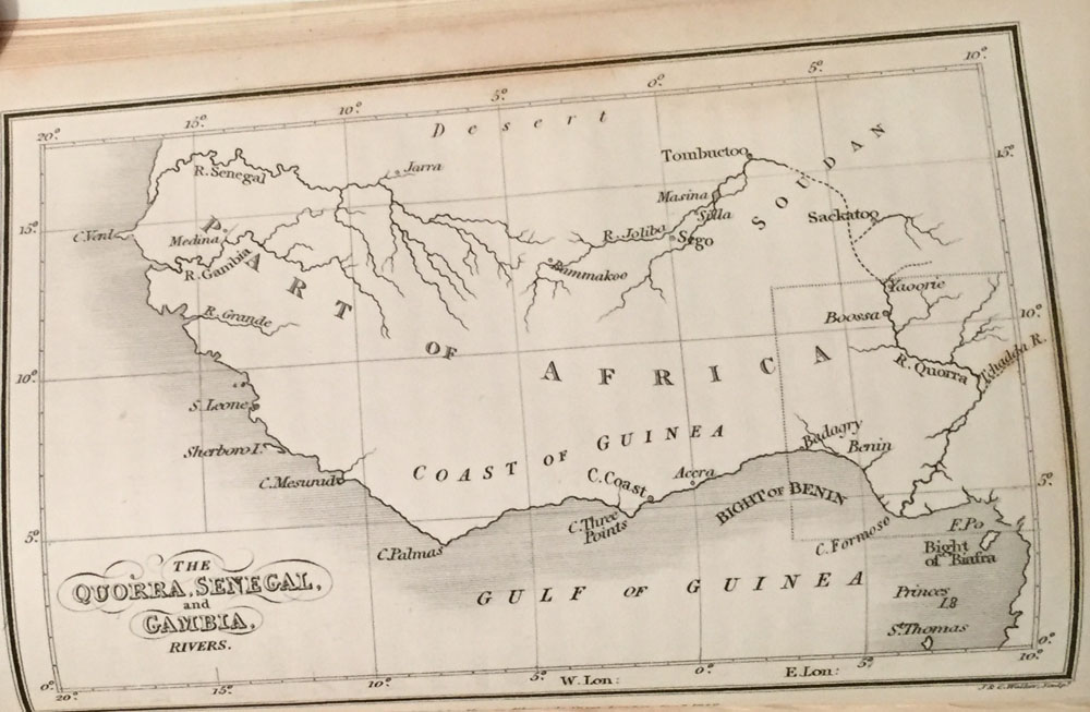
Volume 1- An engraving of Richard Lander;- 2. An engraved Map of Quorra, Senegal, and Gambia, 3. A very large fold-out Map of The Course of the Quorra, The Joliba or Niger of Park, Rivers .1830 and three pages of drawings of Africa Art Figures. All in fine condition.
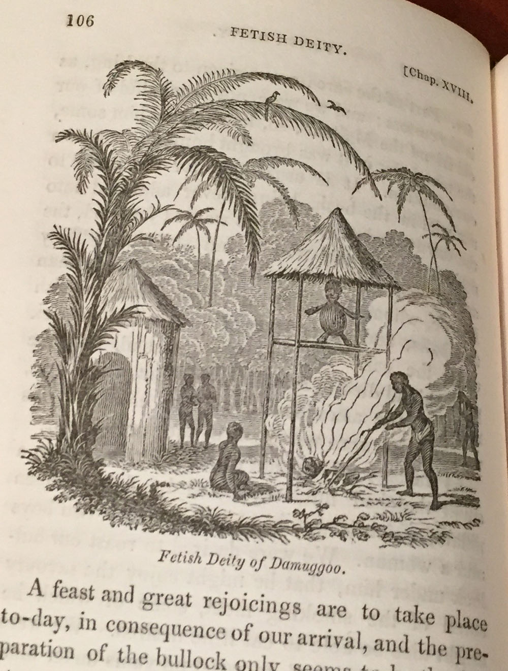
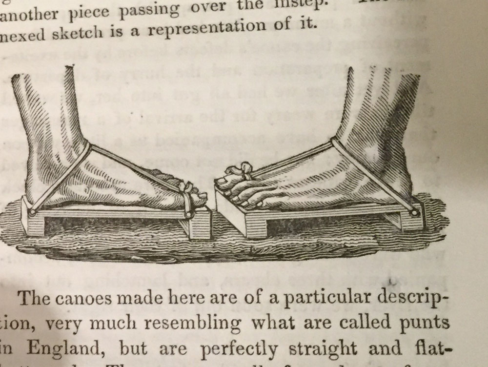
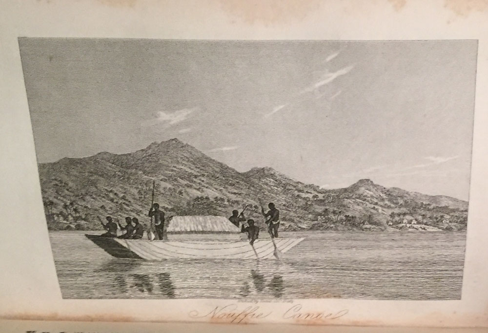
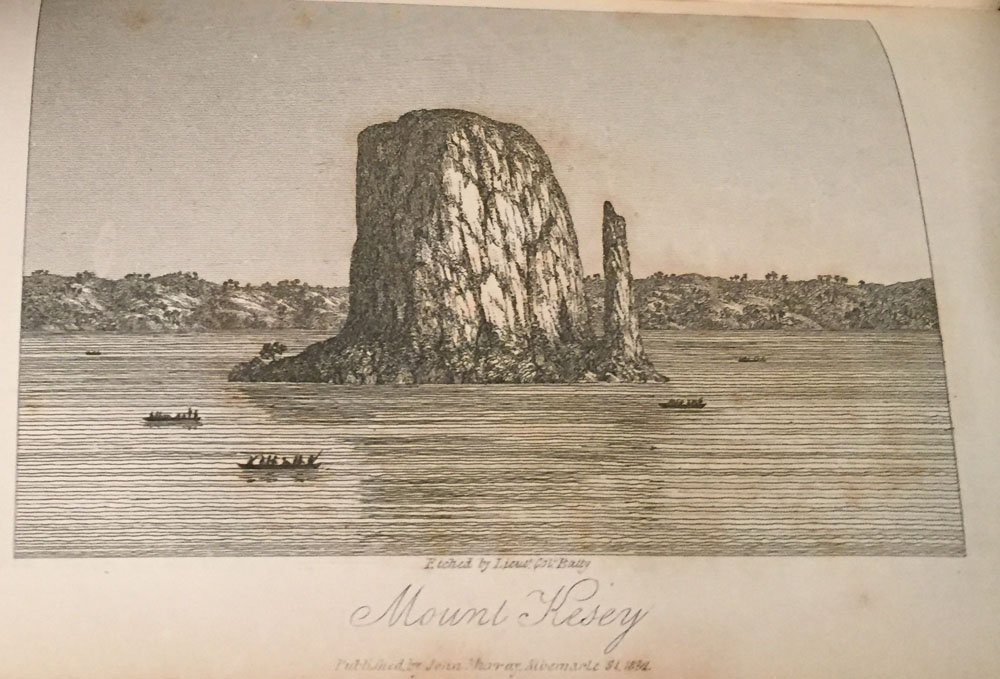
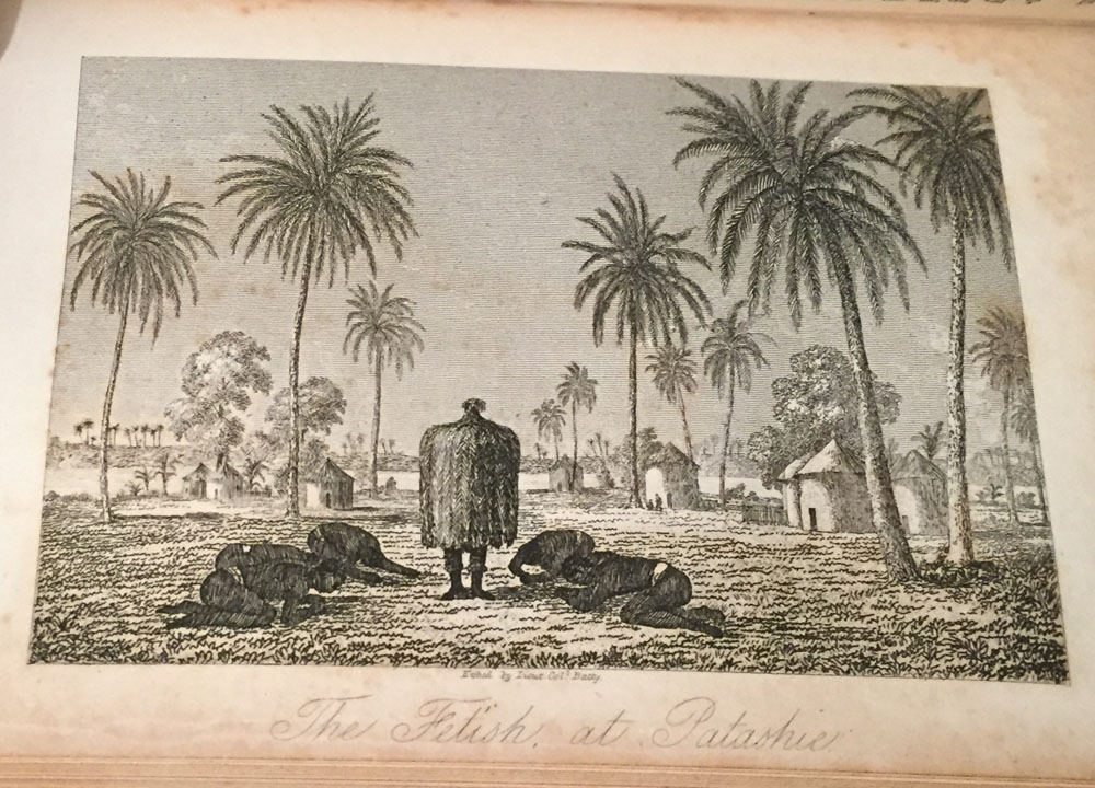
Volume 2- An engraving of John Lander;- and 3 other Engraved Plates;- 1. The Fetish at Patashie;- 2. The Nouffie Canoe;- 3. Mount Kesa;- All in fine condition.
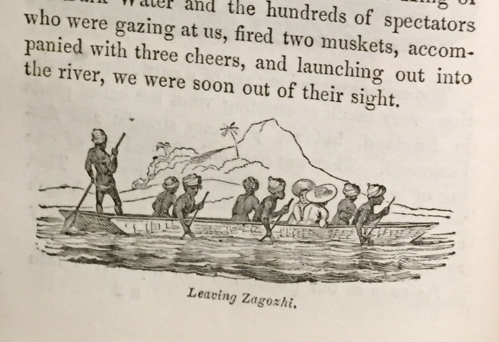
Volume 3;- Engraved Plates;- 1. Banks of the Quorra ;- 2. The Eboe Canoe;- and smaller engraving throughout the text. In very fine condition;-
Appendix to the last pages of volume 3;- Re-bound in half brown leather with dark green cloth covers. In Highly collectable condition;- Gilt lettering to the spines of all 3 volumes;- All Plates & Maps present...Richard Lander had previously served with Hugh Clapperton on the latter's second and last expedition into the African interior, his account of which was published in two volumes in 1830. That year Lander, together with his brother John, undertook an expedition to explore the course and termination of the Niger River. They travelled from Cape Coast Castle to Accra, Bogádry, Boussa (where Mungo Park was killed), and finally Yaoorie, a further one hundred miles upstream. Returning to Boussa, they began their descent of the river in canoes. During the journey they were robbed and mistreated by natives, and at Eboe (Ibo) were held for ransom by the King. Eventually they reached the mouth of the Niger, accomplishing their mission, and arrived back in England in July of 1831. Richard was awarded a gold medal, and John Murray, the publisher, offered the brothers one thousand guineas for their Travel Journals, which were edited for publication by Lieut. Alexander Bridport Beche;- Early travel books into Africa. All. Rare/Scarce in such fine condition. All Plates present which is very unusual. No complete copies to be found on the Internet. Early travel books with MAPS of Africa, the Dark Continent of Africa are very sought after and always demand high prices.
Journal of an Expedition to Explore the Course and Termination of the Niger; with a narrative of a voyage down that river to its termination.
The 3 Volumes Set is small and was Published in London, in 1832:- by John Murray;- A true 1st. Edition with 9 Engravings including two maps, one very large fold-out map, and numerous small woodcuts throughout the 3 volumes as called for.
All 3 volumes have a frontispiece, opposite the three title pages ;-
Volume 1- An engraving of Richard Lander;- 2. An engraved Map of Quorra, Senegal, and Gambia, 3. A very large fold-out Map of The Course of the Quorra, The Joliba or Niger of Park, Rivers .1830 and three pages of drawings of Africa Art Figures. All in fine condition.
Volume 2- An engraving of John Lander;- and 3 other Engraved Plates;- 1. The Fetish at Patashie;- 2. The Nouffie Canoe;- 3. Mount Kesa;- All in fine condition.
Volume 3;- Engraved Plates;- 1. Banks of the Quorra ;- 2. The Eboe Canoe;- and smaller engraving throughout the text. In very fine condition;-
Appendix to the last pages of volume 3;- Re-bound in half brown leather with dark green cloth covers. In Highly collectable condition;- Gilt lettering to the spines of all 3 volumes;- All Plates & Maps present...Richard Lander had previously served with Hugh Clapperton on the latter's second and last expedition into the African interior, his account of which was published in two volumes in 1830. That year Lander, together with his brother John, undertook an expedition to explore the course and termination of the Niger River. They travelled from Cape Coast Castle to Accra, Bogádry, Boussa (where Mungo Park was killed), and finally Yaoorie, a further one hundred miles upstream. Returning to Boussa, they began their descent of the river in canoes. During the journey they were robbed and mistreated by natives, and at Eboe (Ibo) were held for ransom by the King. Eventually they reached the mouth of the Niger, accomplishing their mission, and arrived back in England in July of 1831. Richard was awarded a gold medal, and John Murray, the publisher, offered the brothers one thousand guineas for their Travel Journals, which were edited for publication by Lieut. Alexander Bridport Beche;- Early travel books into Africa. All. Rare/Scarce in such fine condition. All Plates present which is very unusual. No complete copies to be found on the Internet. Early travel books with MAPS of Africa, the Dark Continent of Africa are very sought after and always demand high prices.